Officials confirm tornado touchdown in southern Manitoba after Wednesday's storm
Swirling skies, intense winds and damaging hail caused damage across parts of southern Manitoba on Wednesday after a pair of supercell storms roared across the province.
"It was a very active day of weather yesterday. The big stories are the hail and wind damage with this," said Environment Canada meteorologist Jason Knight.
Parts of roofs were torn off in Beausejour and trees and power poles were snapped.
"We had some trailers tossed, some sheds destroyed, and it's still under investigation whether that was just a large downburst from the storm or perhaps a tornado," Knight said. "[There are] lots of funnel cloud reports and wind damage all under investigation this morning."
DON'T MISS: Peas, walnuts and golf balls: here’s what hailstone size means for damage
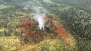
In a tweet on Thursday night, the Northern Tornadoes Project said it had confirmed a tornado touched down near Washow Bay, a small community north of Riverton.
One of the storms formed just north of Winnipeg shortly after 5 p.m., and the other was about 160 kilometres north near Fisher River.
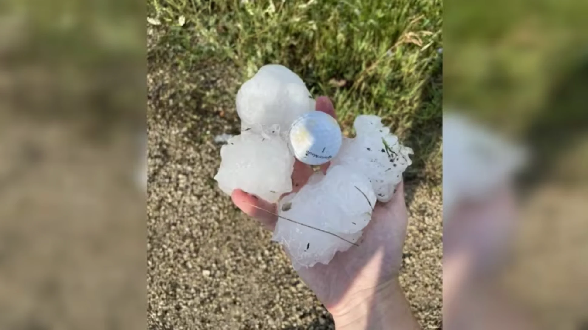
The largest hail reports were grapefruit-sized chunks in the Fisher River area.
"That's 10 centimetres across," Knight said.
The ice smashed windshields and even cracked the metal roofs of trucks, he said.
There was also tennis ball-sized hail in Lockport and baseball-sized hail in Falcon Lake all the way through to the Ontario border.
Reported hail sizes:
Fisher Bay/Fisher River — 10 cm.
East Selkirk — 7 cm.
Falcon Lake — 7 cm.
Lockport — 6.4.
St. Andrews — 5.
Selkirk — 5.
Tyndall — 4.5.
Garson — 4.
Rennie — 3.
A supercell is a large rotating thunderstorm that tends to keep its structure as it travels, instead of forming and collapsing.
"And unfortunately, in doing so, they tend to be organized severe weather for a very long time, which is what we saw last night," Knight said.
"These were very classic, very large supercells. After these storms formed, they needed a tornado warning in fairly short order."
Beausejour Mayor Ray Shirle was in a council meeting when the power went out. He then started getting calls about a possible tornado in the southeast corner of the community, which is about 35 kilometres northeast of Winnipeg.
"Right from roofs missing to a chain-link fence that was tangled up like a ball to [small structures] at CPTC [the Canadian Power Toboggan Championship grounds] that are not even there anymore. There's buildings that are completely destroyed and smashed down to pieces," Shirle said.
The CPTC grounds were littered with snapped lumber and shingles, broken siding and mounds of insulation. Not far away, a business is now missing half of its roof, Shirle said.
WATCH: Nickel, golf ball, baseball; what these hail sizes mean for damage
RELATED: Tornado-warned storms hit Manitoba with baseball-sized hail, damage
He's relieved the impact was in a commercial area with few people around, rather than a residential one. There is a recreation complex nearby, where people were playing baseball, but they vacated the diamond before the storm landed.
"We're very, very fortunate that nobody got hurt in our community. You can replace buildings," Shirle said.
Chief David Crate of Fisher River First Nation says a number of panels in the community's solar farm were ruined in the storm. Houses and vehicles were also damaged, he said, but the full extent of the destruction isn't yet known.
"We've had major storms come through the community in the past, but nothing with the hail that we've seen yesterday evening," he said in an interview on CBC Manitoba's Radio Noon on Thursday.
Storm chaser Michael Nowak headed up to Fisher Bay, north of Fisher River, and said the aftermath of the storm made the highway look like a war zone.
About two kilometres southwest of the bay, the road and ditch were covered with grapefruit-sized hailstones.
"It was by far the biggest hail I've ever seen. I've never seen such crazy damage," he said. "I can't imagine how big the hail must have been in that spot, [because] those pictures were taken about 20 minutes after the storm passed."
When he drove through Fisher Bay, Nowak saw dented vehicles and broken siding on buildings.
"There was extensive damage," he said.
One thing Wednesday's storms didn't have much of was rain, Knight said. They weren't like the storm system that moved through southern Manitoba earlier in the week, bringing a major soaking.
"Radar totals [on Wednesday] indicated perhaps a swath of 40 millimetres from Selkirk east to the border with Ontario, but Selkirk itself only picked up 17 millimetres," Knight said.
There is another thunderstorm risk through most of southern Manitoba on Thursday afternoon as the temperature heats up, "but this is more of the run-of-the-mill risk of a thunderstorm, more more of that stuff we ordinarily see this time of year," Knight said.
"We're not expecting it to be severe."
Cooler temperatures in the low 20s are expected for the weekend.
"But the heat and humidity return on Monday, so we could be doing all this again next week," Knight said.
Environment Canada asks anyone who has photos of possible tornadoes and any damage they may have caused to call 1-800-239-0484, email storm@ec.gc.ca, or tweet them with the hashtag #mbstorm.
This article, written by Darren Bernhardt, was originally published for CBC News.
Header image credit: Storm chaser Michael Nowak shows off some of the hailstones he found near Fisher Bay, with a golf ball in the centre for size comparison. (Michael Nowak/Facebook)