Slight tornadic threat with severe thunderstorms over northwestern Ontario
Intense heat is setting the stage for severe storms in northwestern Ontario this week, so folks could see heavy rainfall, strong winds and hail if these cells develop.
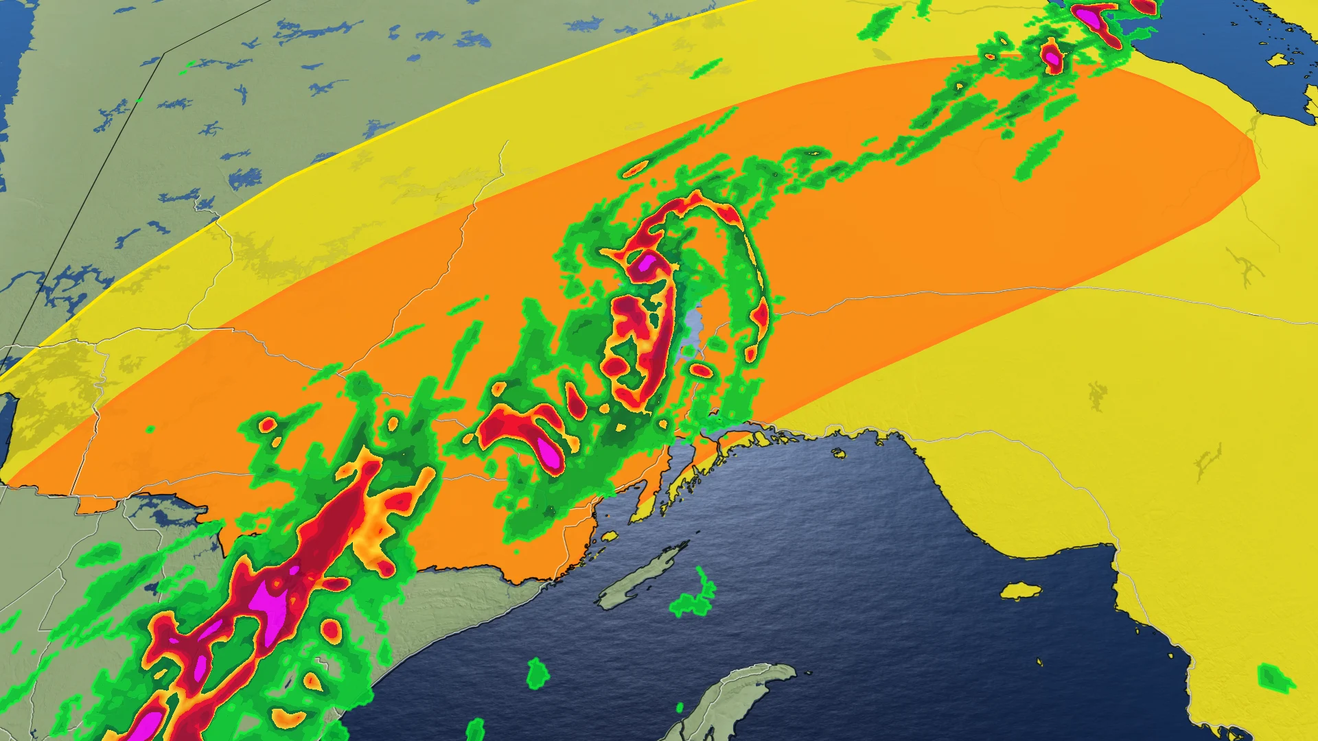
The week begins on a stormy note across parts of northwestern Ontario, as the rising heat and humidity fuel the threat for severe thunderstorms.
After Sunday's round, which included a tornado warning, the threat reappeared on Monday, with a more widespread risk taking aim through the day on Tuesday.
RELATED: Watch? Warning? How we communicate severe weather in Canada
Large hail, strong wind gusts and heavy rainfall will be the primary risks associated with any storms that form. As well, there is a low, but non-zero tornado threat, with the critical timing to watch out for between 6-9 p.m.
It will be important to stay on top of the weather watches and warnings in your area, as conditions can change quickly when severe weather hits.
Tuesday: Severe thunderstorm risk resurfaces in northwestern Ontario
The first round of storms arrived through the overnight hours on Monday, ahead of a warm front and low pressure system. A second and more potent round of thunderstorms will begin to track in through the mid-afternoon on Tuesday, as the cold front slides across the area.

There will be strong, upper-level support, accompanied by deep moisture and the presence of high atmospheric energy.
Good wind shear will be present, providing the final ingredient for the potential for supercell thunderstorms, which include a risk of a tornado. For those to come to fruition, the critical timing will be between 6 and 9 p.m.

DON'T MISS: What to do if a tornado warning is issued
As such, all severe weather parameters are possible including heavy rain, a localized flood risk, large hail, strong wind gusts, and a tornado risk.
Residents in the risk areas are urged to stay weather-aware, and updated on all of the severe weather watches and warnings throughout the day.

Northern Ontario has already seen its fair share of severe weather this month. An EF-2 tornado was confirmed to have occurred on June 4, northeast of Dryden, making it the first EF-2 tornado of 2024 in Canada. An EF-1 downburst has also been confirmed in Owen Sound on June 13.
MUST SEE: How hail – of all shapes and sizes – forms, falls from sky
WATCH BELOW: Tornado safety tips
Stay tuned to The Weather Network for more weather updates across northern Ontario.


