Severe thunderstorms trigger tornado warning in southern Ontario
Severe thunderstorms sweeping into southern Ontario on Wednesday afternoon prompted a tornado warning.
After a windy Tuesday, cloudy skies took over southern Ontario on Wednesday. And while the temperature and humidity are not as unbearable as last week's heat dome, there is still plenty of heat (and therefore, energy) for some powerful storms to develop.
A stateside system of storms and heavy rain has clipped its way into portions of southern Ontario on Wednesday. While most of the storms are remaining south of the border, the warm weather has helped fuel strong lines of storms across the region.
At 1:57 p.m. EDT, Environment and Climate Change Canada (ECCC) issued a tornado warning for Strathroy, Komoka, and Western Middlesex County.
The tornado warning was then ended and replaced by a severe thunderstorm warning shortly afterward.
SEE ALSO: Don’t fall victim to these seven dangerous tornado myths
Meteorologists are currently watching two lines of thunderstorms in the region: one being the previously tornado-warned storm, and the other being a new storm cell further north, around Stratford.
Stay with The Weather Network for updates and forecast information on the severe weather in southern Ontario.
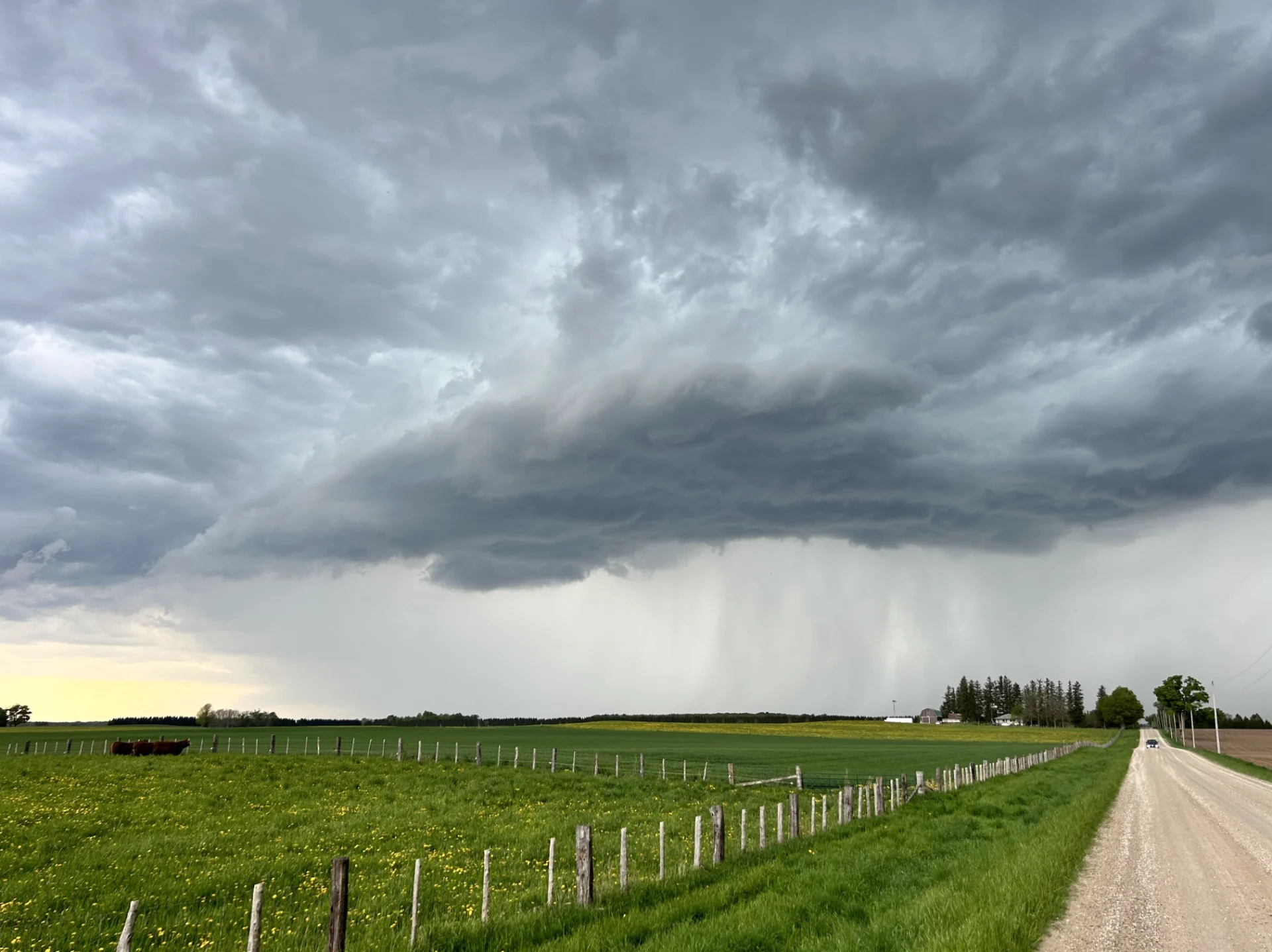
Thumbnail image taken by The Weather Network's meteorologist Mark Robinson on May 13, 2024.