Snowpack levels across B.C. averaging 56 per cent of normal this January
Recent data from the B.C. government shows extremely low snowpack levels across the province at an average of 56 per cent of normal.
At the same time last year, the provincial average was 82 per cent, according to the Snow Survey and Water Supply Bulletin released on Jan. 10.
The province says 15 snow stations measured all-time record low snowpack at the beginning of January, five of which are in the Lower Fraser region and four within the Upper Columbia snow basins.
The Stikine is the only region where 2024 values are higher than the previous year.
Jonathan Boyd, a hydrologist with the B.C. River Forecast Centre, says it's unusual to see so much of the province experience below-average snowpack levels.
"In 2001, the sites that are still active today averaged about 67 per cent of normal. And in 2003 it was 70 per cent," he said.
"So, to be down at 56 per cent this year is extremely low."
Potential for drought
Because of the extremely low snow conditions, the province is warning of the potential for significant drought come spring.
Joseph Shea, associate professor of environmental geomatics with the University of Northern British Columbia, says it could affect crucial systems like the availability of drinking water.
"If you have a low snowpack and an early melt-off, you'll see river levels trending lower than usual and that has implications for communities that rely on rivers for drinking water," he said.
He pointed to McBride, B.C., which has been in a significant state of drought since last summer.
The village, about 180 kilometres east of Prince George in central B.C., declared a state of emergency on Sept. 19 and restricted water usage the following day while under Stage 5 drought conditions — the highest level on the province's severity scale.
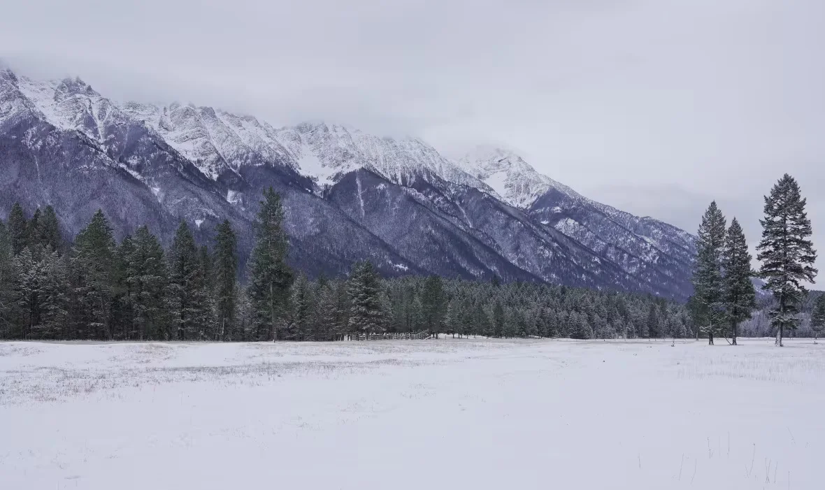
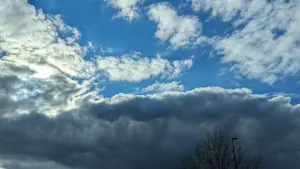
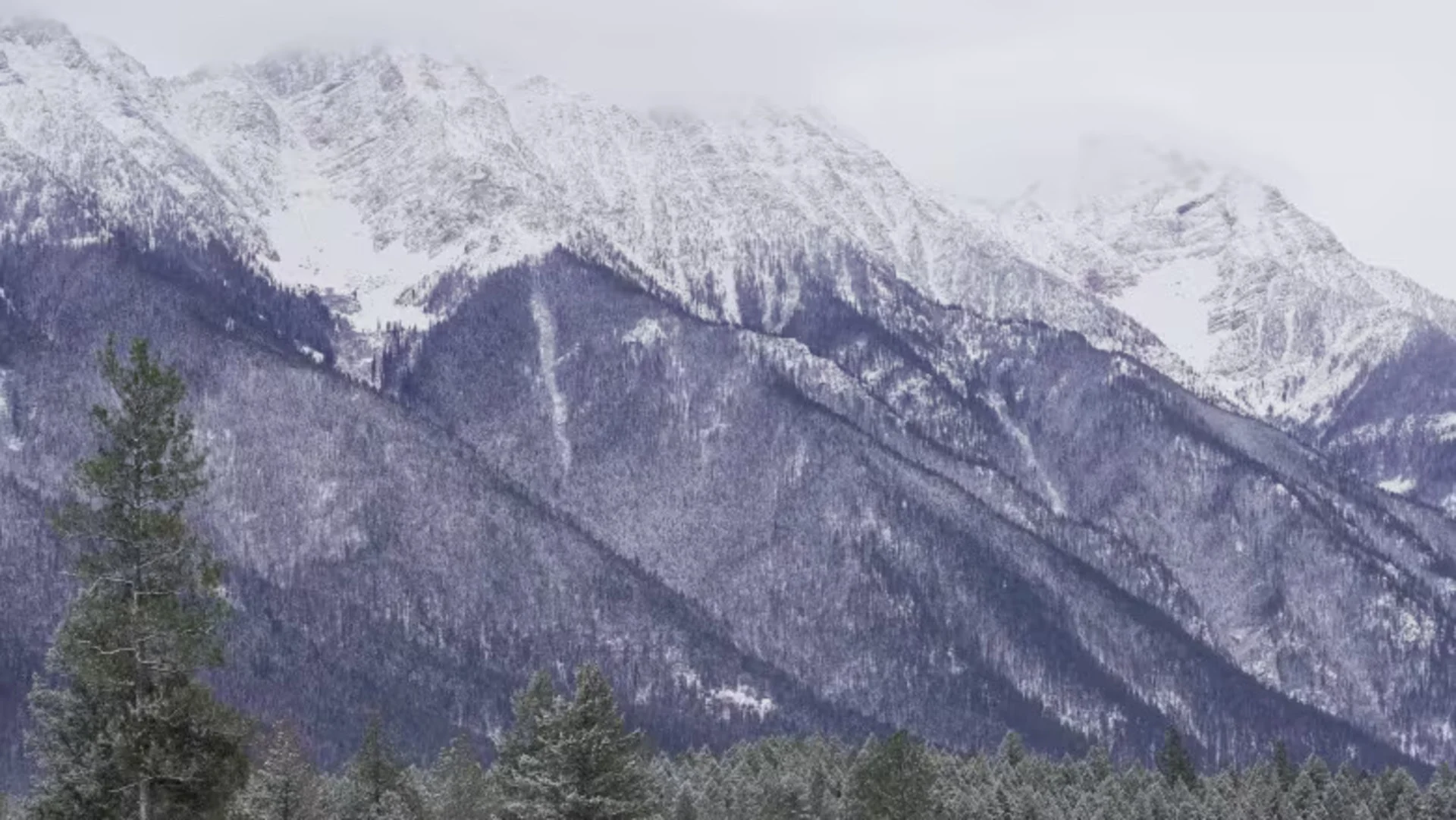
The Steeples Mountain range is pictured in December 2023. With the low snowpack, the province is warning of the potential for significant drought come spring. (Corey Bullock/CBC News)
SEE ALSO: Cold-related emergencies: Staying warm and safe in Canadian winters
McBride Mayor Gene Runtz says while recent snow and incoming cold temperatures are welcome, the village is still concerned.
"The picture is still awfully gloomy," he told CBC News.
"We do have contingency plans to ship water in, if need be, from Valemount. But the cost to do this and keep drinking water into the town is really, you know, a big price."
Shea says a low snowpack can also have an effect on agriculture and forests, and it's key for soil moisture.
"The snowpack is really important for a huge range of things and if we don't get as much as we normally do and it melts off earlier that could spell a lot of problems next summer," he said.
Warmer than usual start to winter
According to the snow and water bulletin, several weather stations in B.C. measured the warmest December on record including Victoria, Campbell River, Vancouver, Abbotsford and Williams Lake.
Some of the warmer conditions can be attributed to the El Niño weather pattern, which is typically linked to warmer winters across British Columbia.
Greg Utzig, conservation ecologist with Kootenay Resilience based in Nelson, B.C., says it's also because of the changing climate.
He says combining the El Niño with climate change, we are more than likely to see another hot summer in B.C.
"It means that you're starting out with very dry forests come spring and if we move into a hot summer, it could be very bad in terms of wildfire season," he said.
Still time to improve snowpack, experts say
Utzig says there is hope with several months left in the winter season.
"In terms of the long term impacts through the spring and summer, a lot can happen between now and May or June," said Utzig.
"So it's no guarantee that we're going to end up with a low snowpack, but there's no question that we're starting this winter in a very low position."
Shea agreed, stating that a few "good storms" could bring the snowpack up to more normal levels.
"We do know that winters are long in this province and in the mountains especially," he said.
"We're going to see snow continue to accumulate up until April or even May in some cases. So that's the good news, I think there's still a lot of time for snowpacks to recover."
This article was written by Corey Bullock for CBC News.