
B.C.: Intense rainfall forces state of emergency, road closures

Heavy rain has led to widespread flooding, road closures, power outages, and at least one declared state of emergency in British Columbia on Saturday.
The hardest-hit regions on Vancouver Island have seen upwards of 300 mm of rain since Thursday, with widespread totals nearing and in some areas exceeding 100 mm both on the island and the mainland. BC Hydro reported more than 20,000 customers without power as of around 1 p.m.
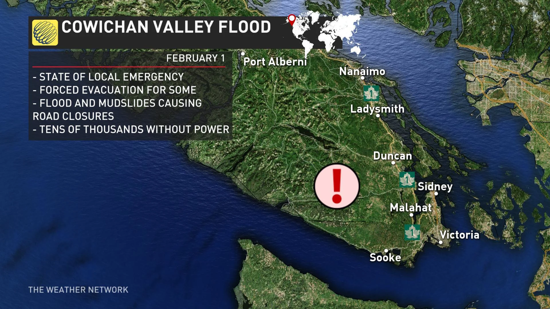
Severe flooding prompted the closure Trans-Canada Highway in several places on the island, including south of the Chemainus River Bridge, cutting the highway between Nanaimo and Victoria (it was reopened in the late morning). Other closures in the area left the community of Crofton completely cut-off, prompting officials to evacuate residents overnight. A state of local emergency was declared for the Cowichan region early Saturday morning, and about two dozen people have had to take shelter in the Cowichan Community Centre.
The Cowichan region isn't the only part of southern B.C. dealing with damaging floodwaters. Mudslides and bridge washouts have disrupted travel and stranded drivers on Vancouver Island's west coast, as well.
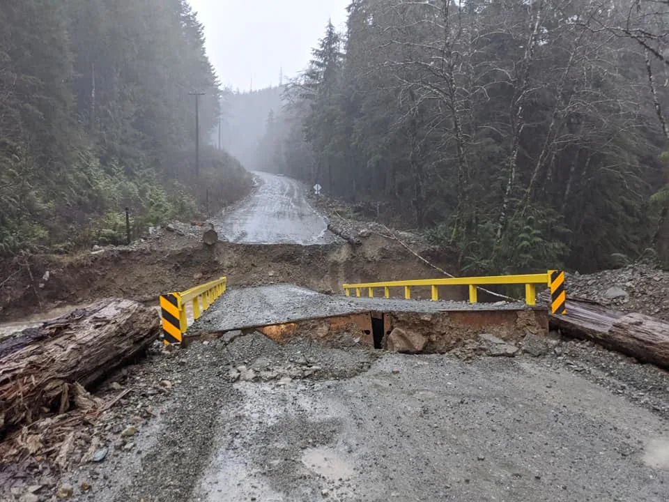
Bridge washout near Bamfield, B.C. Image courtesy Ken King.
Port Coquitlam offered sandbags to homeowners, along with opening an emergency shelter for displaced residents. The Regional District of Nanaimo reported "significant flooding" on the Nanaimo and Englishman rivers Saturday morning.
A mudslide triggered by the heavy rains near Agassiz also closed the road to the resort at Sasquatch Mountain, stranding 500 people. Power was also out at the resort Saturday.
Drive BC has reported numerous other closures across the southern tier of the province, including a handful of sections of the Trans-Canada Highway.
On the mainland, residents reported significant flooding of low-lying areas and farmland near Abbotsford. Environment Canada says nearly 120 mm of rain fell in the Abbotsford area between Thursday and Saturday morning.
Full-fledged Flood warnings were issued for West and South Vancouver Island by 10 a.m. local time, with some rivers near a 100-year flow, according to the BC River Forecast Centre, prompted by the heavy rain. Flood watches are also in effect for Metro Vancouver, the Fraser Valley, and the rest of of Vancouver Island, where officials warn that rising river levels may lead more waterways to exceed their banks.
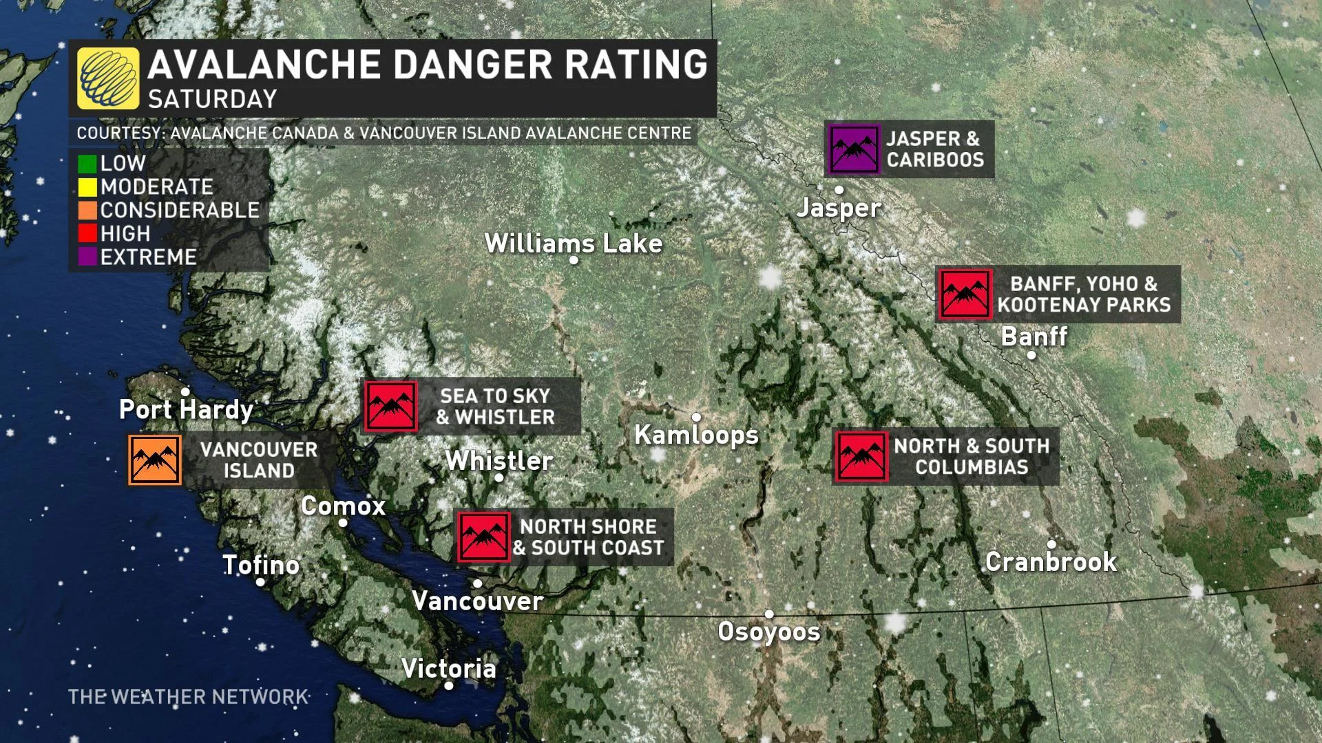
In the mountains, avalanche danger is high across most of the province's ranges, and extreme in Jasper National Park.
Thumbnail image: Ken King, Bamfield B.C.
Sources: Drive BC | CBC News | BC River Forecast Centre


