How B.C.'s catastrophic rainfall, flooding was foretold days before

What began as an ordinary rainstorm had quickly escalated to the beginnings of a significant event on Sunday, Nov. 14, making a major flood unavoidable, according to Tyler Hamilton, a meteorologist at The Weather Network.
The warning signs of B.C.'s epic rainstorm this week appeared as early as Nov. 9, according to Tyler Hamilton, a meteorologist at The Weather Network.
Word of rising freezing levels for the South Coast for Remembrance Day came as early as Tuesday, Nov. 9. The forecast had indicated a "pineapple express" was in the works. For reference, a pineapple express is the name given to a potent band of tropical moisture originating from the deep tropics near the Hawaiian Islands. It can target the West Coast from B.C. to California. It's an example of an atmospheric river.
RELATED: B.C.: Devastation unfolds, 250+ mm of rain washes out roads, forces evacuations
Then, computer model guidance on Thursday, Nov. 11 had suggested that more than 200 mm of rain was headed for the Fraser Valley. By Saturday, Nov. 13, it was evident that Victoria's "rain shadow" would fail, Hamilton says, as a stream of moisture pushed into Squamish and other areas.
"It started just as an ordinary rainstorm, but by Sunday, [Nov. 14], things quickly escalated. Highway 1 became impassable. The flow forecast models by then indicated we could not escape a major flood event," said Hamilton.
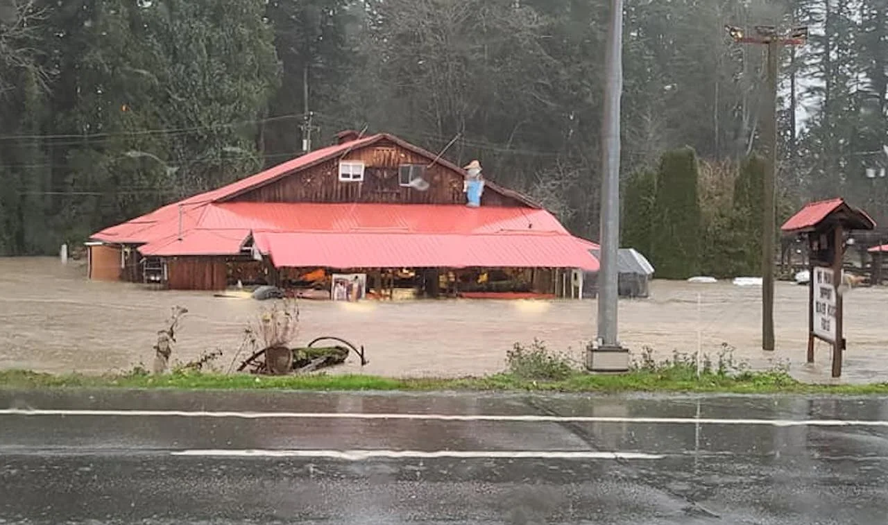
The impact has been dramatic: Numerous mudslides and rockslides were reported as rain-saturated mountain and hillsides shifted. Highway 1 was one of several that were reported closed in both directions at multiple locations. One of the mudslides resulted in at least one confirmed fatality, and multiple people are unaccounted for, according to Lillooet RCMP.
As well, the significant flooding prompted several communities to issue evacuation orders or alerts, and in Merritt, it caused the complete failure of the municipality's wastewater treatment plant. City officials called it an "immediate danger to public health and safety."
On top of that, more than 100,000 customers were without power at the height of the storm, according to BC Hydro.
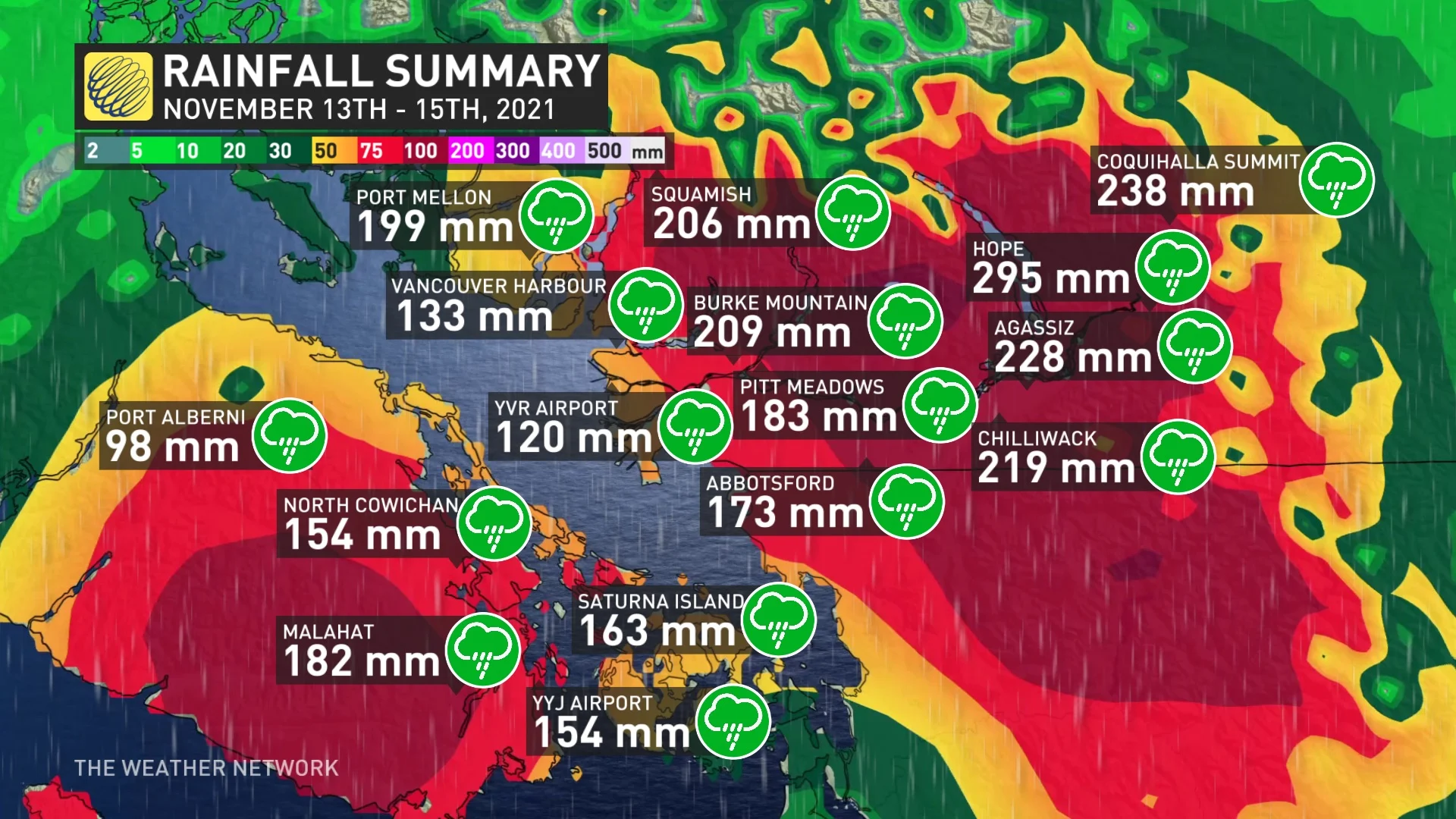
The storm brought some substantial rainfall amounts, with several locales in the Fraser Valley and Interior shattering all-time daily records. Here are some of the preliminary rainfall totals (in millimetres) from Saturday night to Monday.
Vancouver International Airport: 120, Pitt Meadows: 183, Cloverdale: 169, White Rock: 157, West Vancouver: 157, Vancouver Harbour: 133, Abbotsford: 173, Agassiz: 228, Chilliwack: 219, Hope: 295, Squamish: 206, Port Mellon: 199, Whistler: 114, Sechelt: 82, Powell: River 80, Victoria International Airport: 154, Victoria University: 120, Esquimalt: 103, Saanichton: 159, Malahat: 182, North Cowichan: 154, Qualicum Beach: 92, Kennedy Lake: 143, Port Alberni: 98, Entrance Island: 123 and Saturna Island: 163, among others.
Watch the video above to get the full story on how this monumental and destructive event unfolded days in advance, and the impacts it left behind.
Thumbnail courtesy of Kathy Williams-Parkinson/Facebook/Submitted.


