More rounds of rain threaten already flood-vulnerable areas of B.C.

With very little time to dry out from last week's damaging atmospheric river system, another such system is in the midst of drenching the province once more. Though amounts won't be as extreme, they come when much of the areas that experienced flooding and mudslides are still waterlogged, raising flood risk as runoff finds its way into already high rivers. Beyond, two more such systems are targetting the province into next week. For a closer look at timing and impacts, see below.
INTO FRIDAY: FIRST SYSTEM WINDS DOWN
People across the south of B.C. woke to more rain Thursday as this latest atmospheric river crept southward, having begun deluging the North and Central coasts the previous day.
By Friday morning, the peak of this system will have passed, and the rain will cease throughout the morning. By then, 40-80 mm of rain is possible in the Fraser Valley, and 100-200 mm for parts of western Vancouver Island.
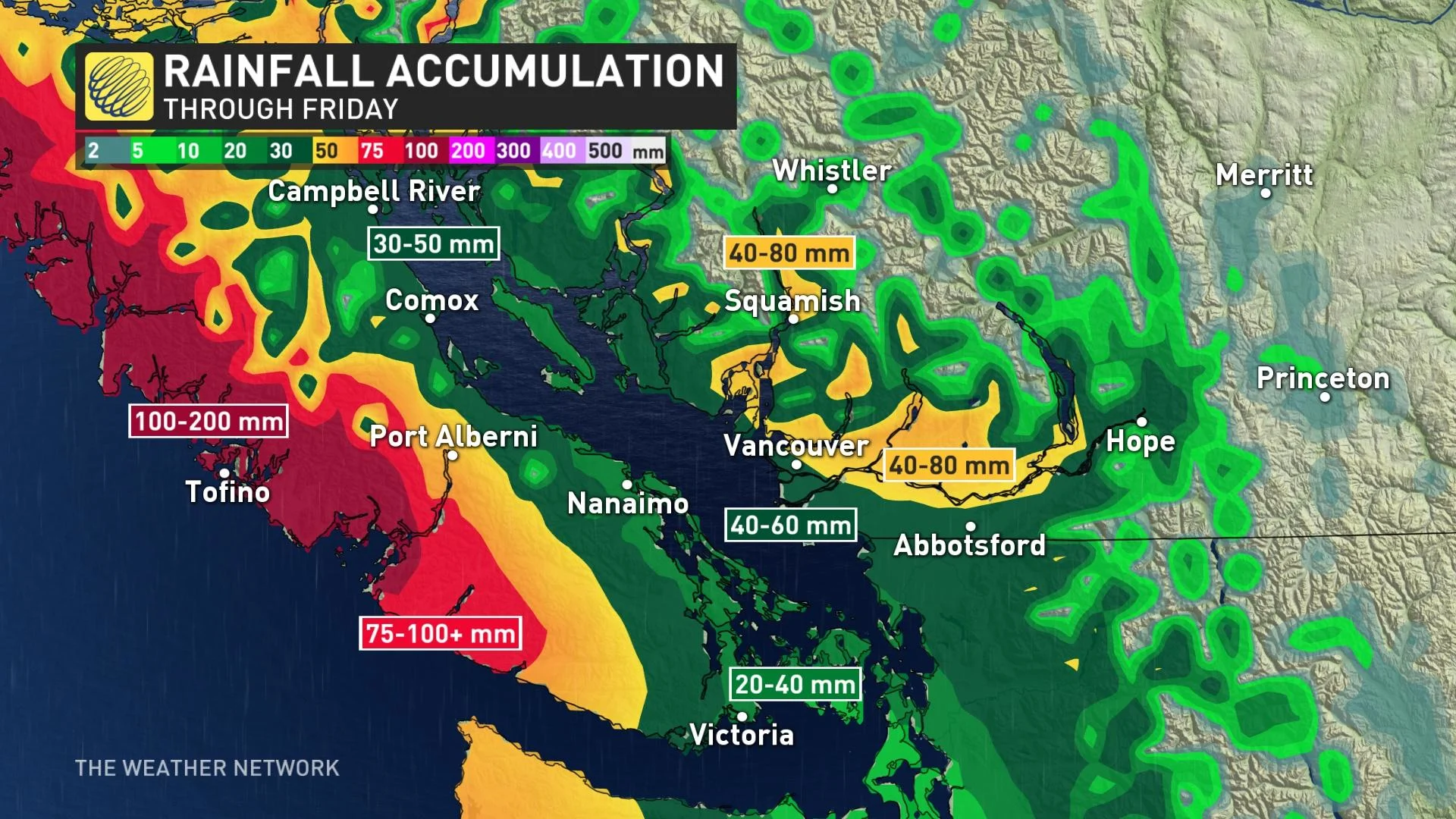
Though this system, on its own, has been tamer and less intense than the event over November 13-15, it's still a serious concern for people in the region, chiefly because the sheer amount of rain that fell last week has left most areas thoroughly waterlogged, with little chance for the soil to absorb the runoff.
As such, much of this system's rains will end up once again in the region's swollen rivers. At the moment, the Lower Fraser and South Coast watersheds are under a flood watch, and all other watersheds at or near the coast are under a high streamflow advisory.
Worsening matters, freezing levels soared above 2,000 metres Thursday, with many high-elevation areas already having several centimetres of accumulated snow.
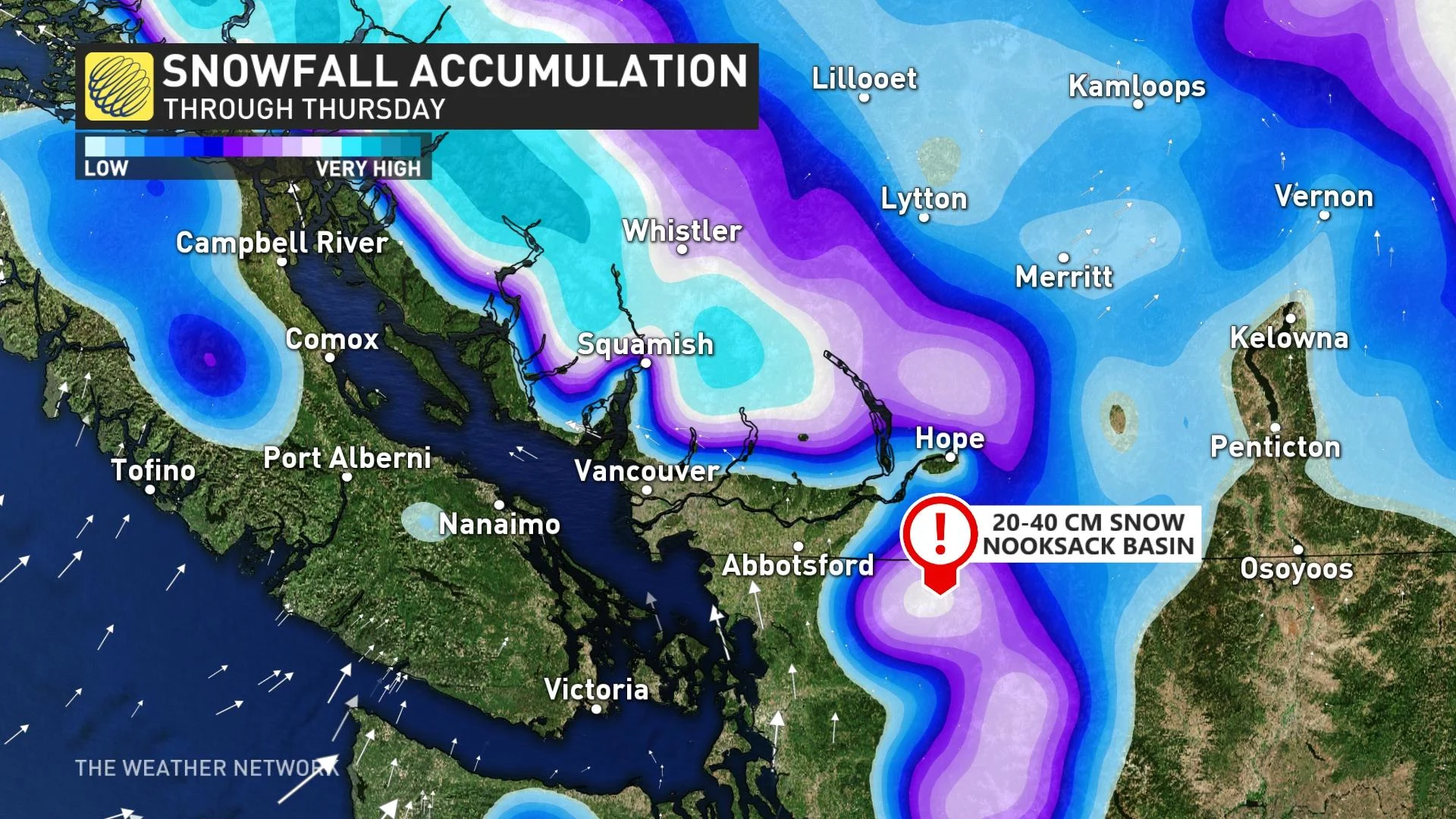
That's still more moisture ready to pour into the system as snowmelt, compounding flood risk.
"This may worsen recent flooding and impact vulnerable landscapes and infrastructure," Environment and Climate Change Canada warns.
LOOK AHEAD: SECOND ATMOSPHERIC RIVER INBOUND FOR THE WEEKEND, POTENTIAL FOR MORE WET WEATHER
Beyond the first event, the next system is set to move in Saturday evening and continue through Sunday, but the current forecast is for the heaviest rain to be situated over central B.C. and western Vancouver island once again.
With these new accumulations, parts of the North Coast and western Vancouver Island will have picked up more than 200 mm over the course of the two systems, with more than 100 mm for parts of the Lower Mainland.
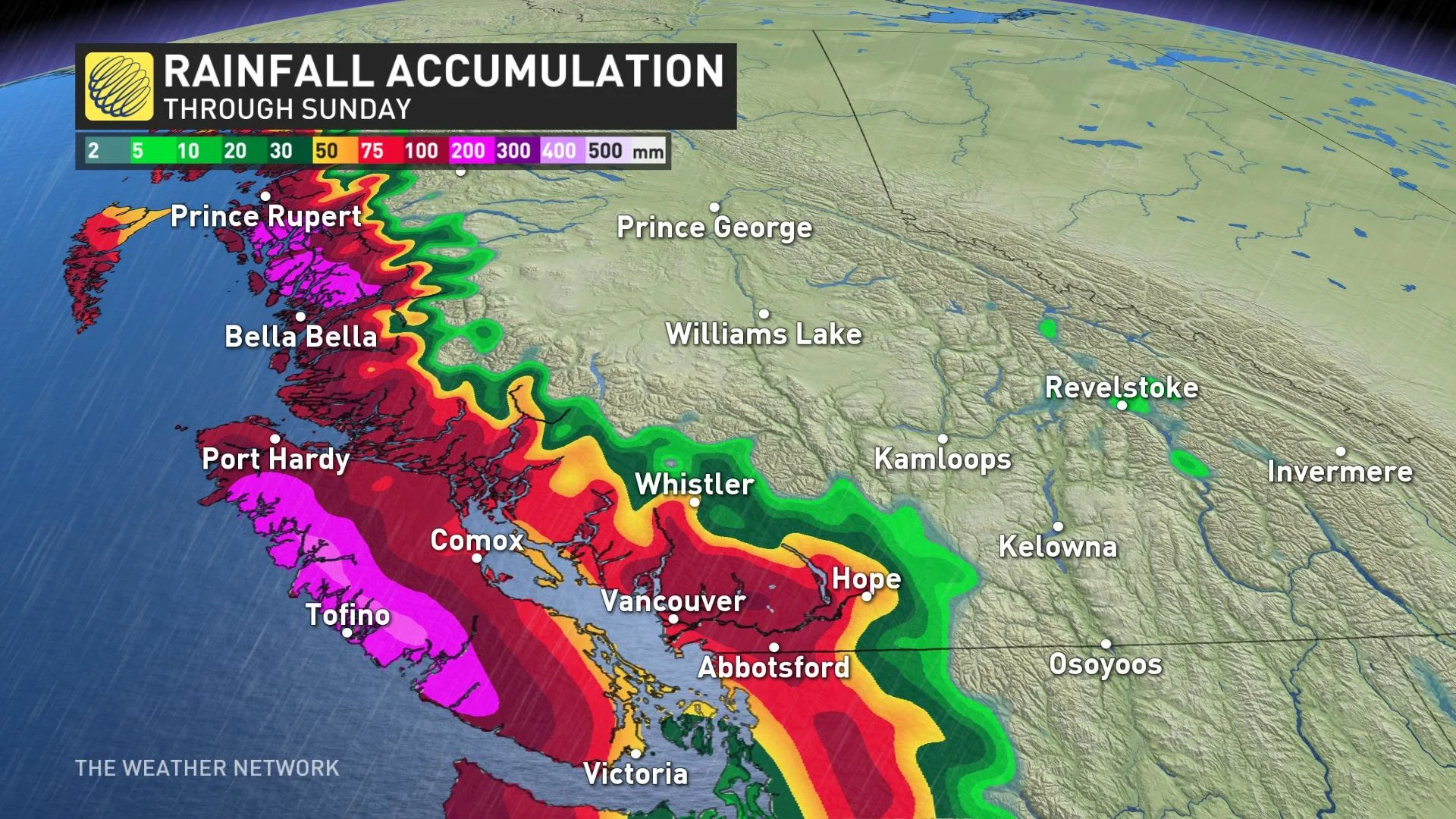
That won't be the end of it, either, as another system is expected early next week Tuesday to Wednesday. Seven-day rainfall totals of 75-125 mm are anticipated for much of the Lower Mainland, with 125-250+ mm for alpine regions and the west coast of Vancouver Island.
Mild temperatures are forecast for late week and on the weekend for the South Coast.
CANADA GETTING ITS OWN ATMOSPHERIC RIVER RATING SCALE
Check back as we continue to monitor this week's rainy systems.