Sailing a drone into a hurricane could help predict ferocious storms

Sailing a drone into a major hurricane can provide meteorologists valuable data that helps them better understand and predict hurricanes in the future.
A monstrous hurricane churning over the open ocean is a spectacle to behold. We’ve long observed these powerhouses through satellite data, buoy observations, and critical measurements taken by intrepid Hurricane Hunters flying airplanes into the heart of the storm.
But what if we could get invaluable data by sailing directly into the eye of the storm?
It would be too dangerous for humans to do that, of course, but it’s the perfect mission for a fleet of uncrewed drones specially designed to withstand the brutal conditions of a scale-topping hurricane.
A DRONE VENTURING WHERE HUMANS DON’T DARE
The U.S. National Oceanic and Atmospheric Administration (NOAA) and Saildrone Inc. recently released stunning video captured by a drone sailing into the eyewall of Category 4 Hurricane Sam as it roared over the central Atlantic Ocean.
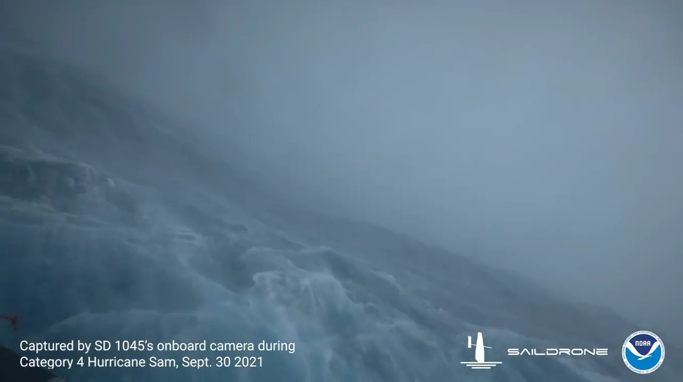
A snapshot of footage captured by Saildrone Explorer SD 1045 in Hurricane Sam's eyewall on September 30, 2021. (NOAA/Saildrone Inc.)
The Saildrone Explorer SD 1045 battled the full fury of Hurricane Sam’s eyewall on the morning of September 30, enduring 15 m waves and winds stronger than 190 km/h to send back a first-of-its-kind video right from the core of the storm.
“SD 1045 is one of a fleet of five ‘hurricane’ Saildrones that have been operating in the Atlantic Ocean during hurricane season, gathering data around the clock to help understand the physical processes of hurricanes,” according to a NOAA-issued press release on September 30.
The release added that the drone is “equipped with a specially designed ‘hurricane wing,’ enabling it to operate in extreme wind conditions.”
A BETTER UNDERSTANDING OF HURRICANES
Sailing a drone into the eye of a powerful hurricane makes for gripping visuals, but there’s a more noble purpose to the mission than just collecting awesome footage.
“New data from saildrones and other uncrewed systems that NOAA is using will help us better predict the forces that drive hurricanes and be able to warn communities earlier,” NOAA scientist Greg Foltz said in the press release.
The high-stakes nature of hurricanes makes understanding these storms a top priority for meteorologists. However, it’s not as simple as measuring the storm’s winds and looking at the environment around it.
HURRICANE FORECASTING IS A TRICKY BALANCING ACT
Hurricanes are a fantastic example of the interconnected nature of our planet’s atmosphere. These mammoth storms are as beholden to global weather patterns as they are to the finest inner-workings of the thunderstorms within the eyewall.
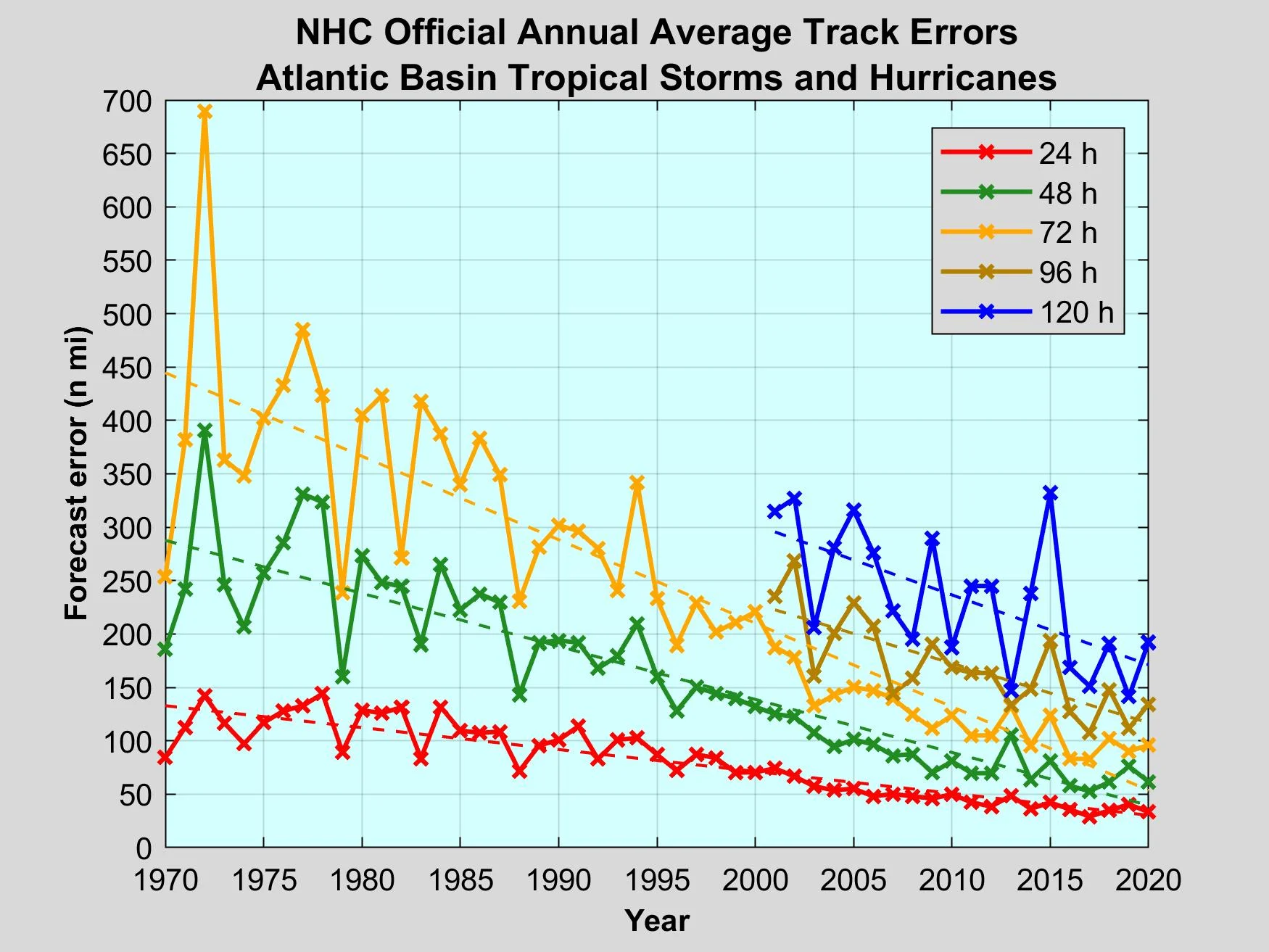
A chart showing the U.S. National Hurricane Center's official annual average track errors for tropical storm and hurricanes between 1970 and 2020. (NOAA/NHC)
The track of a hurricane is often dictated by large-scale steering patterns. Troughs and ridges can tug and pull on storms, sending them careening into the coast or trekking safely out to sea.
The U.S. National Hurricane Center (NHC) has made tremendous improvements in hurricane track forecasting over the years. A five-day hurricane track forecast today is about as accurate as a two-day hurricane track forecast was back in 1992, the same year that Category 5 Hurricane Andrew devastated southern Florida.
Meteorologists have fine-tuned both their weather models and their knowledge to better understand how the big picture affects hurricane tracks, which can give folks along the coast plenty of time to prepare for an approaching storm.
INTENSITY FORECASTS STILL LAG BEHIND TRACK FORECASTS
While meteorologists have a better understanding of what steers a hurricane, they’re still learning more about what drives a hurricane’s intensity.
A hurricane’s intensity is as much dictated by the structure of the storm itself as it is by environmental factors around the storm, such as sea surface temperatures. After all, a budding tropical cyclone can’t take advantage of warm waters if its structure is a mess.
Satellite data and routine Hurricane Hunter flights give us a great snapshot of what’s going on inside of a storm, but there’s still more to learn. The data collected by Saildrones could provide models and meteorologists an extra boost in understanding how these storms strengthen.
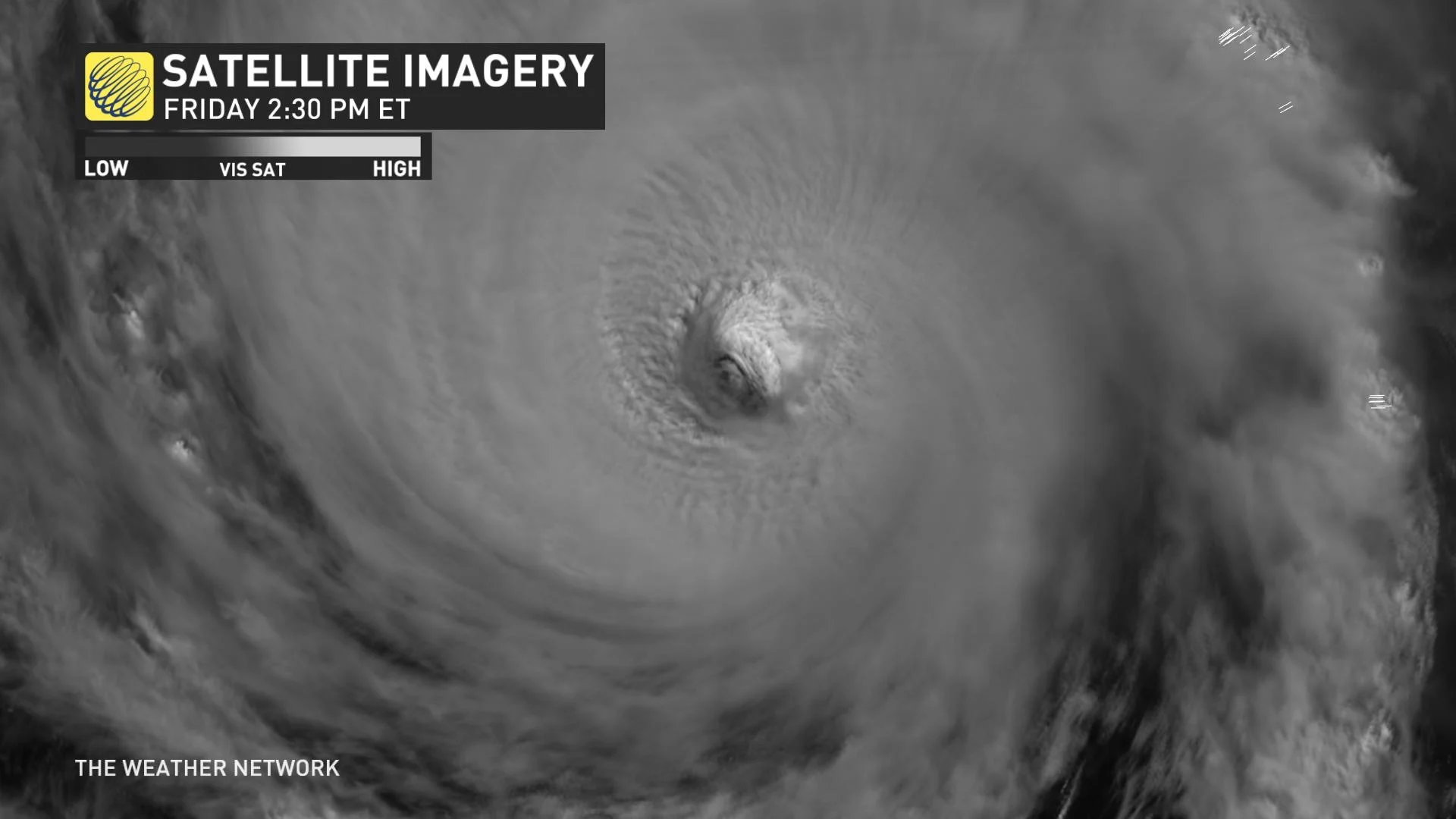
A visible satellite image of Category 4 Hurricane Sam on October 1, 2021.
One major concern is rapid intensification, which occurs when a storm’s maximum sustained winds jump about 55 km/h within a 24-hour period.
Multiple destructive hurricanes over the past couple of years rapidly intensified as they closed in on the coast, including Hurricane Ida this year, Hurricane Laura in 2020, Hurricane Michael in 2018, and Hurricane Harvey in 2017.
Hurricane Sam itself underwent several periods of rapid intensification, jumping from a tropical depression to a Category 4 hurricane in about two days.
Better understanding of why some hurricanes are more prone to explosive intensification than others is key to improving hurricane intensity forecasts. Data collected by the new fleet of Saildrones could help scientists collect crucial data necessary to make these forecast improvements.
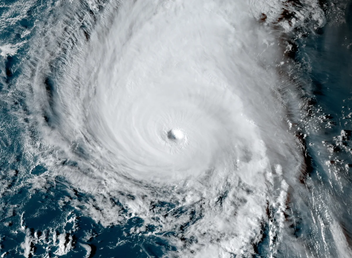
Thumbnail of Hurricane Sam courtesy of NOAA.