Why snow squalls are one of the hardest events to forecast

Weather forecasting is never simple and southern Ontario snow squalls are one of the more difficult events to nail down. Meteorologist and experienced storm chaser, Mark Robinson, breaks down the complexities of this winter phenomenon.
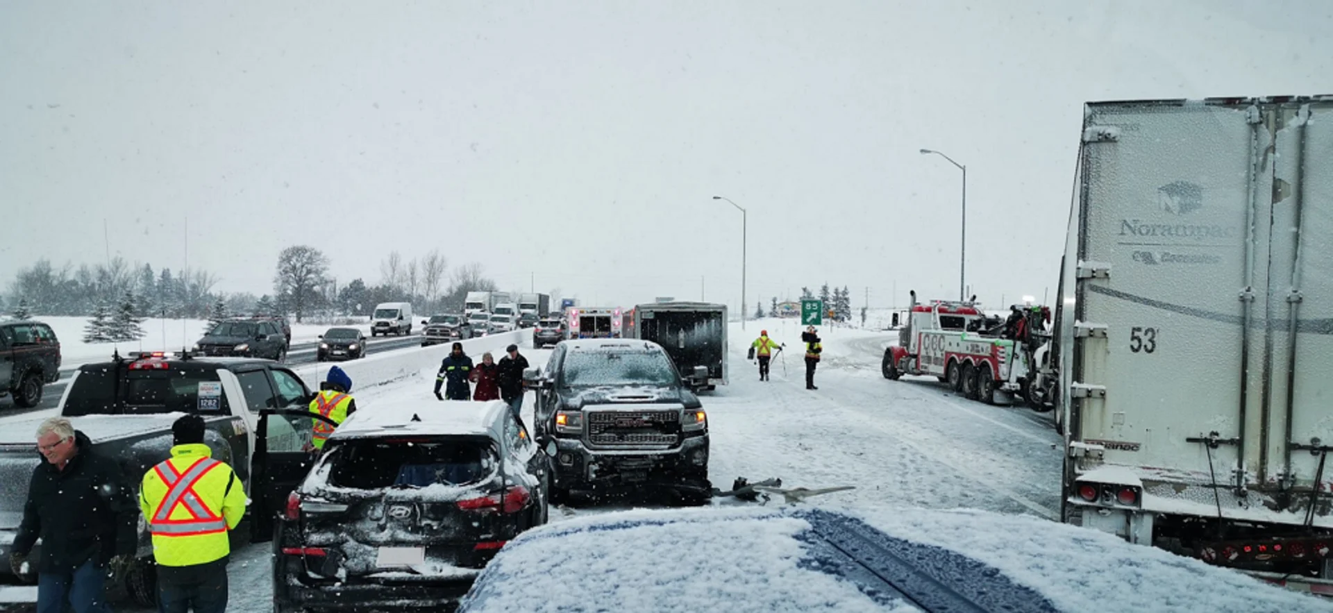
Snow squalls aren’t unique to Ontario, but thanks to the geography of the southern part of the province, they are a big part of winter life there. They’re why we have ski hills like Horseshoe Valley and Blue Mountain. They are also why we deal with massive car collisions on the 400 and 402 highways.
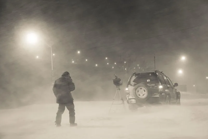
Meteorologist Mark Robinson seen filming with The Weather Network amid a snow squall. Courtesy: Mark Robinson
Squalls (more correctly known as “lake effect snow”) occur as cold air sweeps in over the ice-free Great Lakes in early winter or late fall in the wake of a major storm system. The cold, dry air “picks up” moisture from the, relatively, warm lakes, continues over the land and dumps the moisture as snow.
Sounds simple, right? Forecasters (like myself) should be able to tell everyone exactly where and when they’re going to occur. They should never end up on the 401 trying to figure out exactly where the edge of the road is while frantically checking the rearview mirror to ensure the car behind me isn’t about to make my day far more … complicated.
You know where this is going.
Weather forecasting is never simple and southern Ontario snow squalls are one of the more difficult events to nail down. There’s a specific set of meteorological conditions that have to be met in order to get squalls going. The two main criteria are (besides having a giant body of water):
A temperature difference of 13 C between the surface of the water and the air temperature at about 850 mb (1.5 km up in the atmosphere). The lakes that surround Ontario are massive and are slow to warm up and cool down, thus ensuring that we can get squalls well into the winter. The bigger the difference in the temperatures, the stronger the squall will be.
A vertical alignment of wind. The longer the fetch (the length of the open water exposed to the cold air), the greater the moisture uptake will be, thus resulting in greater snowfall.
Because southern Ontario is surrounded by the Great Lakes, lake effect squalls are far more common than in any other place on the planet. If a squall locks into place, snowfall rates can top 5 cm or more per hour. Some squalls off Lake Huron have left more than a metre of snow after staying in place for almost a day. Add in the wind and you’re suddenly into blizzard-like conditions that can wreak havoc on highway travel and anything else caught underneath them.
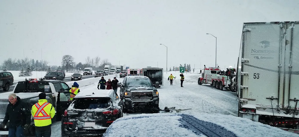
A multi-vehicle pileup shut down parts of Highway 400 NB lanes on December 19, 2019. Courtesy: Heavy Towing & Recovery via The Weather Network.
Unlike large winter storms that hit everything at once, the squalls arrange themselves in narrow bands that may only be a few kilometres (or less) across. Why they do this would take another full article (and yes, I’m writing that one next), but for now, think of the squalls like long, narrow lines of thunderstorms. And yes, they can get strong enough to produce lightning. Meteorologists like to call it “thundersnow”. It’s very rare, but it does happen in the squalls.
Snow squalls also tend to arrange themselves in narrow bands that can waver back and forth depending on the wind. Small variations in geography and ice cover can change how air flows up and onto the land, further increasing the variability of where and how much snowfalls.
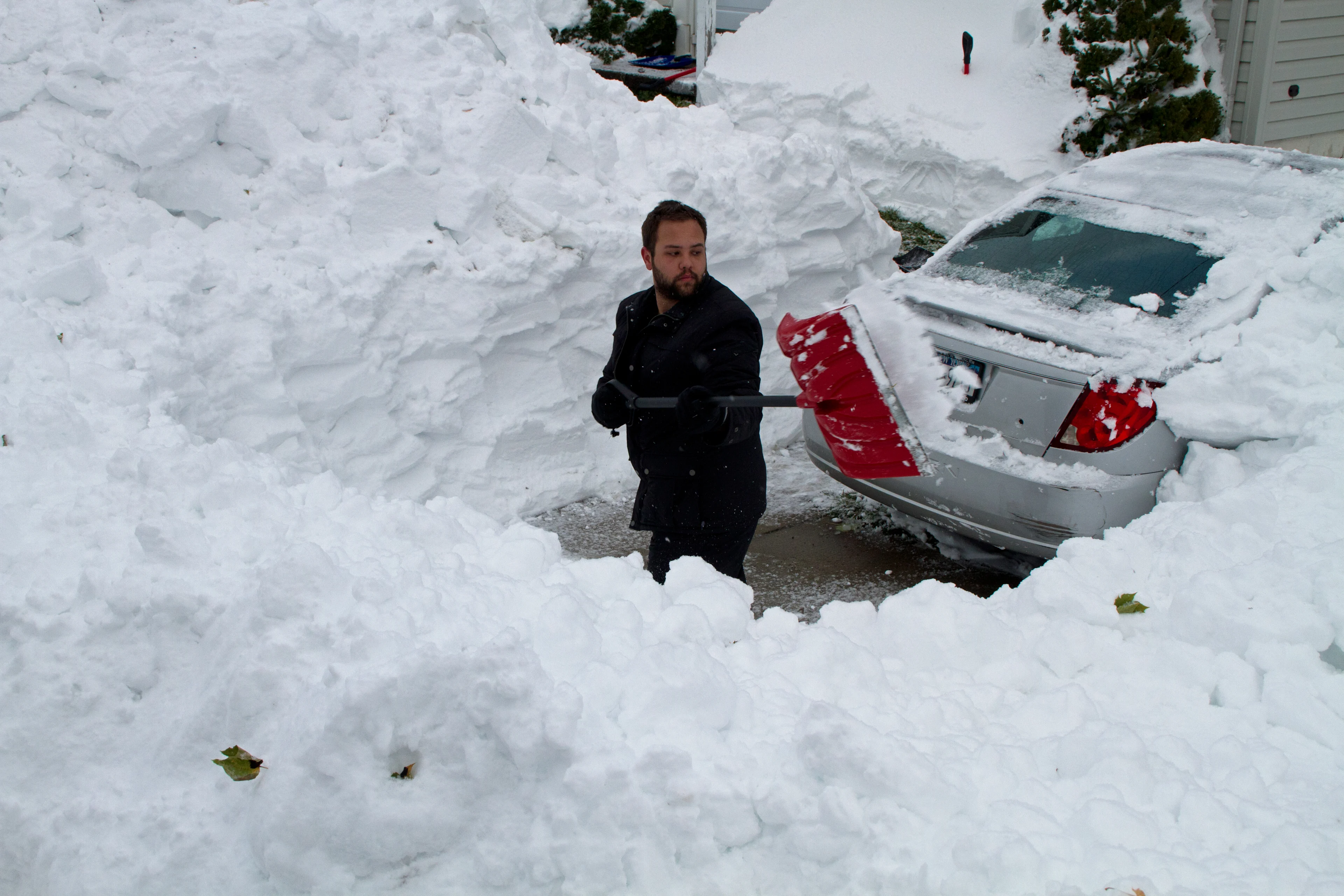
Man seen shovelling after a major lake effect snow event in Buffalo, New York. Courtesy: Mark Robinson
Computer models are good and getting better every day. The problem is that they are still crude approximations of what’s going on in the atmosphere, especially at small scales. We can figure out large atmospheric movements such as the jet stream and where it’s going to be from day to day, but small events like thunderstorms or snow squalls are still somewhat difficult to nail down. It’s simply the nature of weather forecasting without perfect data input and supercomputers that can’t churn through some of the most complex programs ever written in less than a few hours.
METEOROLOGIST ERIN WENCKSTERN EXPLAINS HOW LAKE EFFECT SNOW DEVELOPS:
When we add the population density of southern Ontario into the mix, things get that much more tricky. Two-thirds of all Canadians live in the corridor from Windsor to Montreal and a large chunk of that can be hit by snow squalls. So, if a forecaster is tearing his or her hair out trying to figure out where the squall will set up and they’re just a bit off, believe me, they’ll hear about it. If the snow misses one town, it’s almost inevitable that another town (or highway) will be hit.
Nailing the forecast isn’t easy when it comes to squalls and even I get frustrated trying to document them. But, when you end up in the middle of one, it’s going to feel like you’re in the midst of Snowmaggedon.
But, just wait a bit.
Things will change quickly. Or, maybe it won’t and you’re going to end up stuck in one place for days.
Snow squalls. It’s just one way that southern Ontario is one of the most difficult forecasts in Canada.
--
Editor's Note: This article was originally published in December 2019
Thumbnail image courtesy: Heavy Towing & Recovery via The Weather Network


