14 spectacular photos of Canada from space
theweathernetwork.com
Saturday, July 9, 2016, 10:47 AM - Canada has been a space-faring nation for a long time.
From the launch of Alouette 1 satellite in 1962 -- making Canada only the third nation to put a satellite in space -- to the Canadarm aboard the space shuttle and International Space Station, to Commander Chris Hadfield's stint as ISS commander, our country has a special comfort in Outer Space far out of proportion to its population.
So it's only fitting that the Canadian Space Agency marked Canada Day last week by posting 14 gorgeous shots of Canada taken from space, in various seasons, covering most of the country.
We've reproduced them below, with captions by the CSA. Enjoy!
Sunrise on Western Canada
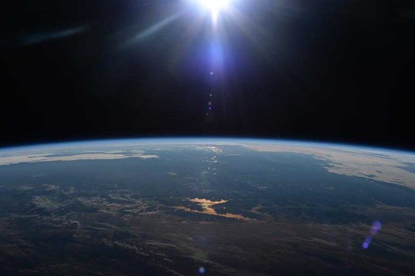
"Sunrise on Western Canada, shot by Tim Kopra from the International space station." (Credit: NASA)
Sun on Vancouver Island
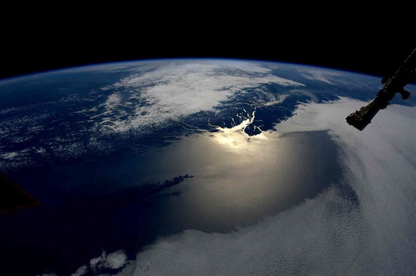
"The ocean around Vancouver Island reflecting the sun." (Credits: NASA, ESA)
Vancouver City

"Vancouver city, photographed by astronaut Tim Kopra from the International Space Station (ISS)." (Credit: NASA)
Heiltskuk Icefield

"The Heiltskuk Icefield covers approximately 3,600 square kilometers of the southern Coast Mountains of British Columbia." (Credit: NASA)
Saskatchewan River

"Part of the Saskatchewan River delta, in Manitoba. The floods following the construction of Grand Rapids Dam, in 1960 created shallow, muddy lakes and bogs (dark green and blue irregular areas)." (Credit: NASA)
Whiting Event in Lake Ontario
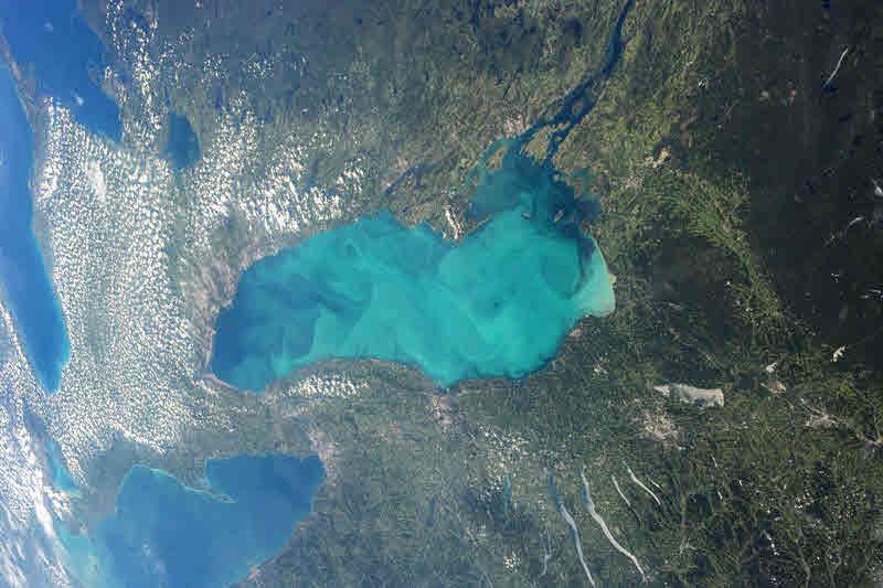
"The exceptional color of the water in Lake Ontario is due to the formation of calcium carbonate. Increased photosynthesis and changes in water temperature allow this to happen. It is those calcium carbonate particles that cause the lightening ("whiting") of the water." (Credit: NASA)
The Great Lakes

"The Great Lakes, shot by NASA's astronaut Terry W. Virts." (Credit: NASA)
Melting sea ice in James Bay

"Melting sea ice in James Bay." (Credit: NASA)
St. Lawrence River

"St. Lawrence's mouth, where the Great Lakes pour into the sea." (Credit: NASA)
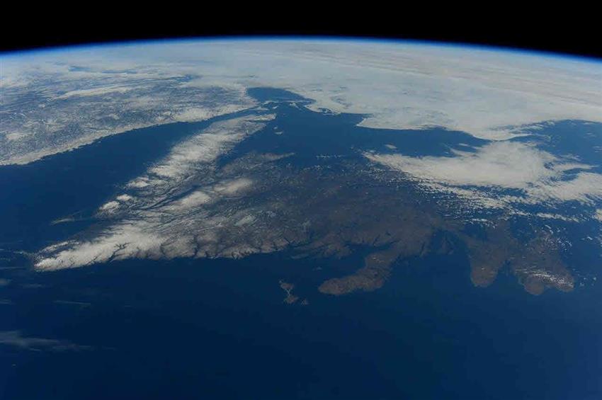
The International Space Station as it flew over eastern Quebec
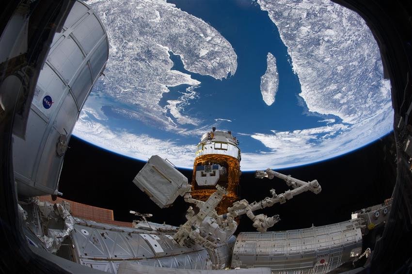
"The International Space Station flies over Eastern Quebec as Canadarm2 is poised to release Kounotori2. Visible in the background is the Gaspé Peninsula, Anticosti Island, Prince Edward Island and the west coast of Newfoundland." (Credit: NASA)
Montreal Lights

"Eastern Quebec at night where we distinguish the illuminated area of Montreal." (Credit: NASA)
Spring in Newfoundland
"Newfoundland, free of cloud, photographed in Spring 2016 by astronaut Tim Peake". (Credits: ESA, NASA)
Belle Isle surrounded by ice
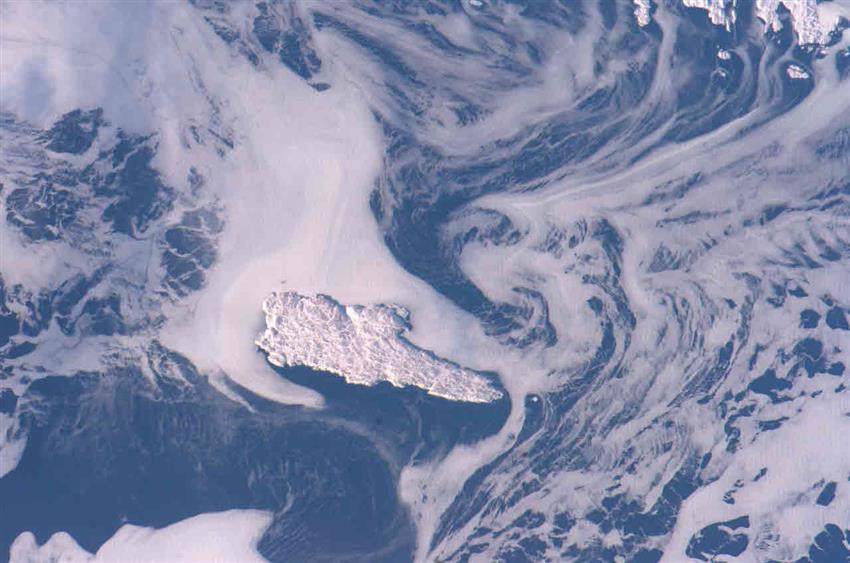
"Belle Isle, Newfoundland, surrounded by sea ice in winter." (Credit: NASA)
Canada from Space
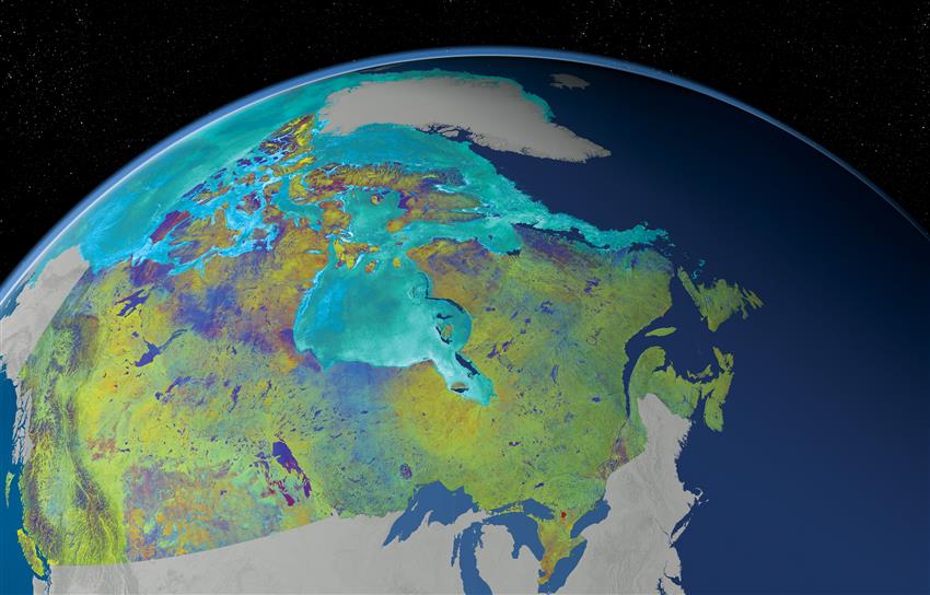
"This is a Mosaic of Canada which is made from 121 images captured by Canadian satellite RADARSAT-2. These images were acquired from May 1, 2013 to June 1, 2013. The color variation represents the changes in soil texture, roughness and the level of soil moisture." (Credit: RADARSAT-2 Data and Products © MacDonald, Dettwiler and Associates Ltd., 2014. In collaboration with the Canadian Ice Service. All Rights Reserved. RADARSAT is an official mark of the Canadian Space Agency.)
SOURCE: Canadian Space Agency


