Pacific hurricane season nearly a record-breaker: Here’s why
Meteorologist, PhD
Monday, July 25, 2016, 12:43 PM - Meteorologists are still rubbing their eyes after seeing seven named storms form in just three weeks around the Eastern Pacific. Georgette, the latest addition to the list strengthen into a category 4 this past weekend although it will weaken during the next 48 hours into a tropical storm as it tracks to the northwest.
This potent and beautifully shaped hurricane has become the seventh named storm in the basin this month which ties the July record for the most named storm formations, set back in 1985.
RELATED: Atlantic hurricane season may be a powerful one this year
The season was off to a very slow start on May 15th and it wasn’t until July 2nd when Agatha, the first storm of the season formed, then Blas, Celia, Darby, Estelle and Frank came one after the other until Georgette. Darby strengthened into a category 3 strength while Blas and Georgette made it to a strong category 4 with sustained winds of 225 km/h. Most storms have travelled WNW along a similar path away from Mexico´s west coast towards Hawaii, although this season the only one to reach the islands so far has been Darby.
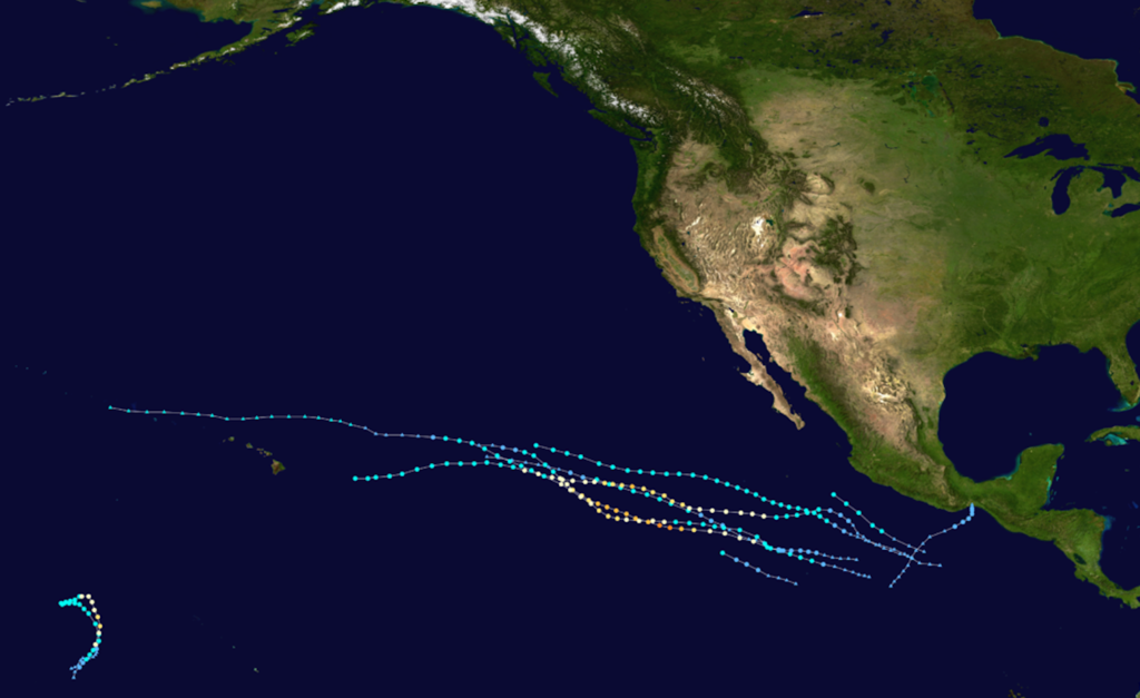
Map shows 2016 East Pacific storm tracks from all 7 storms (via: NOAA)
![]() STORM TOOL KIT: Be prepared for severe weather with The Weather Network's online essentials: ALERTS | LIVE RADAR | UPLOAD PHOTOS/VIDEOS | LATEST NEWS | FOLLOW ON TWITTER | HIGHWAY FORECAST | AIRPORT FORECAST
STORM TOOL KIT: Be prepared for severe weather with The Weather Network's online essentials: ALERTS | LIVE RADAR | UPLOAD PHOTOS/VIDEOS | LATEST NEWS | FOLLOW ON TWITTER | HIGHWAY FORECAST | AIRPORT FORECAST
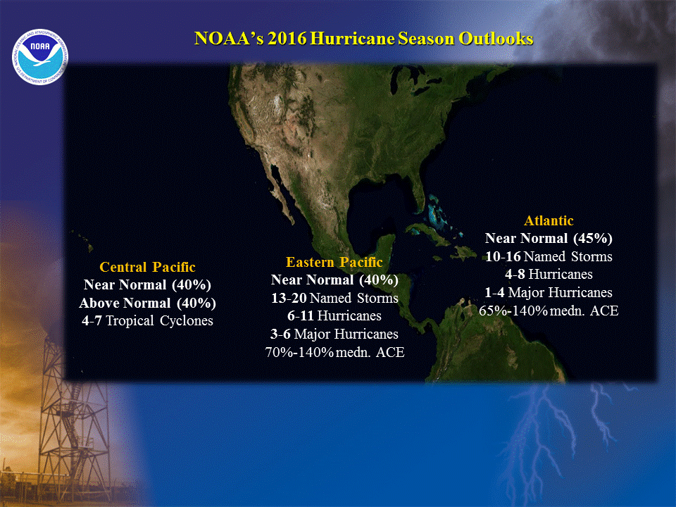
The original forecast published by the Servicio Meteorológico Nacional of Mexico back on may 6th, 2016 contemplated 17 named storms, 9 hurricanes and 4 major hurricanes.
NOAA on the other hand forecasted 13 to 20 named storms, 11 hurricanes and 3 to 6 major hurricanes. Both forecasts where close to a near normal season but made a point about the uncertainty in the prediction caused by the transition taking place this summer in the Equatorial Pacific from El Niño to La Niña conditions.
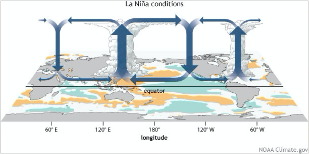
Although La Niña is still developing in the Equatorial Pacific, as gets stronger during late Summer and early Fall we should see tropical convection in the eastern Pacific retracting westward towards Indonesia with an enhanced Walker Circulation. This reduces convection considerably over the eastern Pacific and upper level winds tend to intensify with stronger vertical wind shear dominating the region. The increase of wind shear will then tend to dilute atmospheric conditions favorable for tropical storm development.
![]() What is La Niña? | What is El Niño?
What is La Niña? | What is El Niño?
During the first part of this summer the transition between El Niño and La Niña has been slow but despite that slow transition storm formation in the east pacific in May and June has not occurred mainly due to other atmospheric settings.
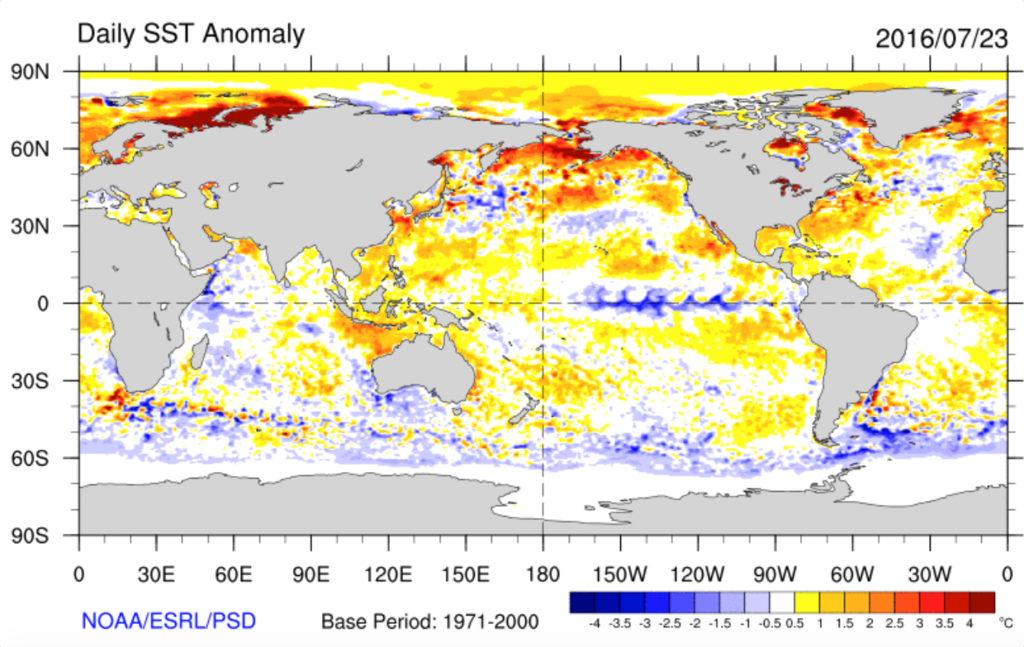
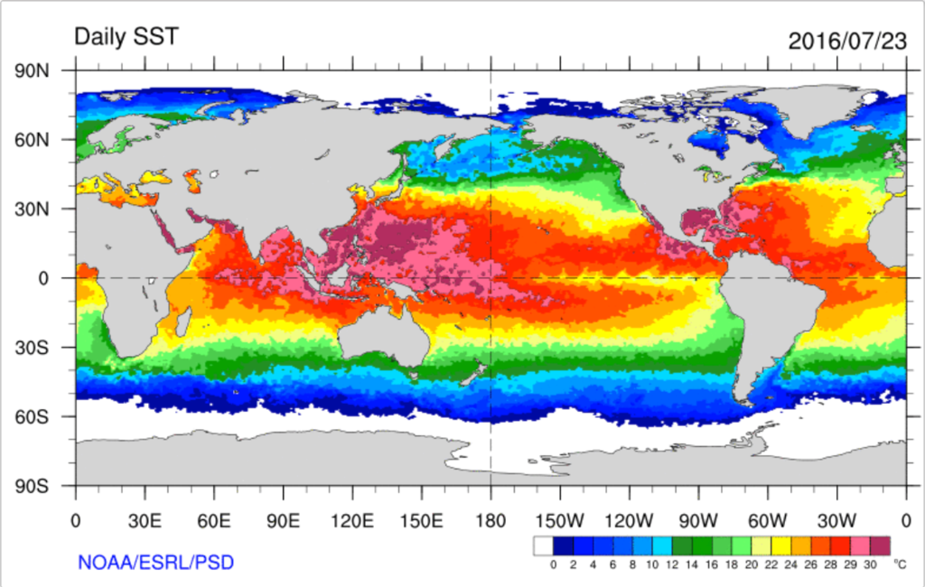
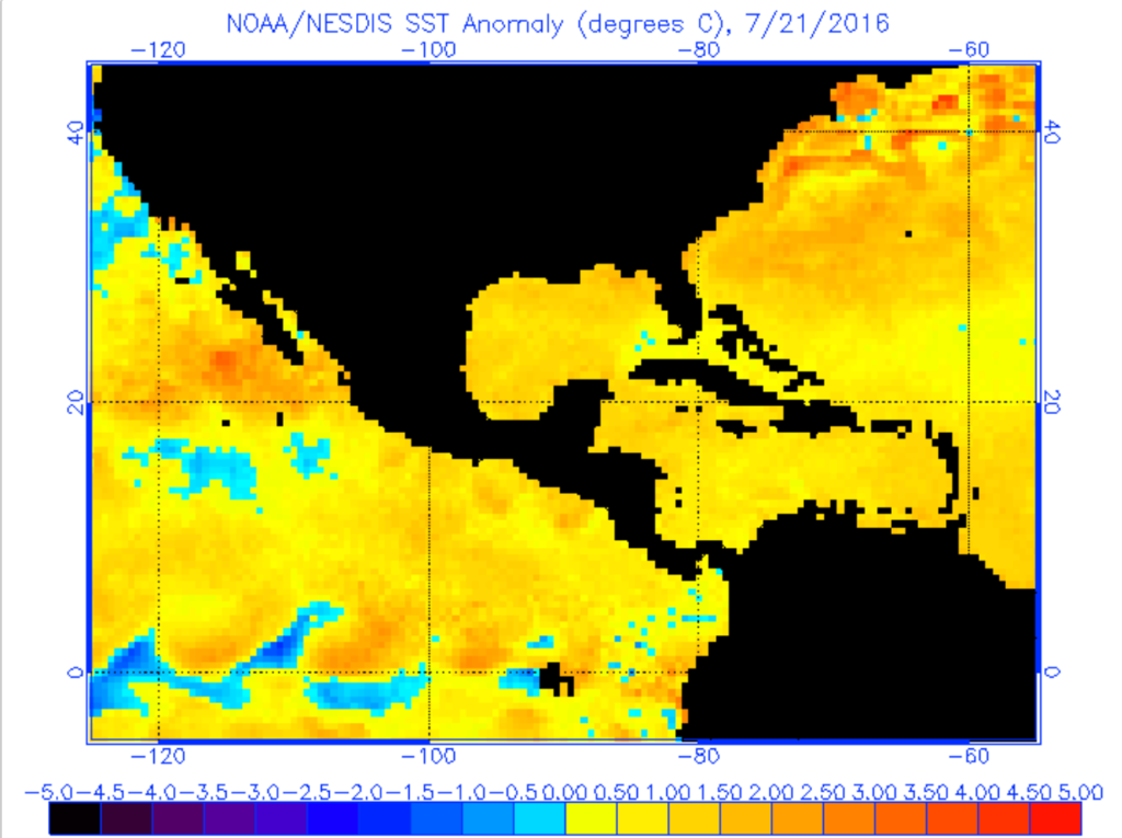
This month of July, SST anomalies off the west coast of Mexico were storms get part of their fuel, have been warmer than usual, and on top of that Vertical Wind Shear in the region has been on the low side and the ITCZ has been positioned well north of its usual position. The ingredients of this atmospheric cocktail have been key to help spin-off a good number of the storms observed this July.
![]() SAFETY: Six important flood safety tips
SAFETY: Six important flood safety tips
And although there is a region of warm SST anomalies extending all the way from the coast of northwest Mexico to Hawaii, all seven named storms have followed a NW trajectory encountering SSTs below 26oC (78.8oF) which limits their potential for strengthening beyond a certain point and increased Vertical Wind Shear as has occurred with Darby and will occur these next few hours with Georgette.
With 7 days left in the month and and after a frantic period of three weeks, if the favorable atmosphere-ocean ingredients hold, we could see Howard spinning around in no time to break the old time record.
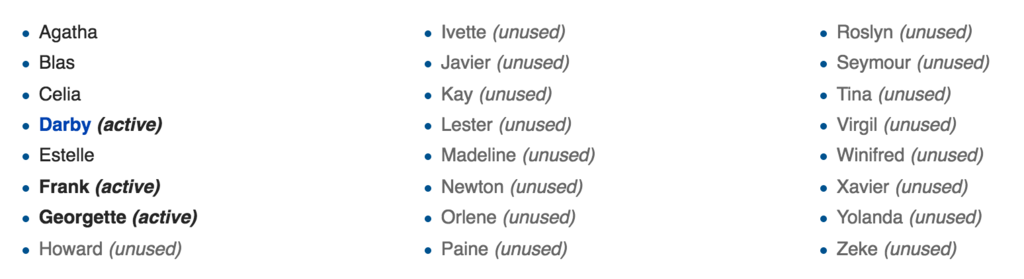
Eastern Pacific Storm Names for 2016: