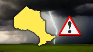
Active Alerts Orfordville, WI
You should monitor later forecasts and be prepared to take actionshould Flash Flood Warnings be issued.
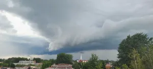
* WHAT...Flash flooding caused by excessive rainfall continues to bepossible.* WHERE...Portions of east central, south central, and southeastWisconsin, including the following counties, in east centralWisconsin, Fond du Lac and Sheboygan. In south central Wisconsin,Columbia, Dane, Green, Green Lake, Iowa, Lafayette, Marquette,Rock and Sauk. In southeast Wisconsin, Dodge, Jefferson,Washington and Waukesha.* WHEN...Until midnight CDT tonight.* IMPACTS...Excessive runoff may result in flooding of rivers,creeks, streams, and other low-lying and flood-prone locations.Flooding may occur in poor drainage and urban areas. Storm drainsand ditches may become clogged with debris.* ADDITIONAL DETAILS...- Rounds of showers and storms are expected to bring heavy rainto southern Wisconsin through tonight. Storms end late thisevening.- http://www.weather.gov/safety/flood
Residents and those with interests near the river should monitorrising water levels and be prepared for possible flood warnings.Additional information is available at www.weather.gov.The next statement will be issued late tonight at 1215 AM CDT.
...The Flood Watch continues for the following rivers in Wisconsin...Illinois...Baraboo River At Reedsburg affecting Sauk County.Sugar River At Brodhead affecting Green, Winnebago and RockCounties.Wisconsin River At Portage affecting Columbia County.* WHAT...Flooding is possible.* WHERE...Sugar River at Brodhead.* WHEN...From Sunday evening to Tuesday afternoon.* IMPACTS...At 5.5 feet, Some roads are flooded about 6 milesdownstream in Avon Township in Rock County. In the Avon Bottomsarea of Rock County, flooding is occurring in Sugar River Park.* ADDITIONAL DETAILS...- At 3:00 PM CDT Saturday the stage was 2.0 feet.- Forecast...Flood stage may be reached late tomorrow evening.- Flood stage is 5.0 feet.- http://www.weather.gov/safety/flood
Motorists should not attempt to drive around barricades or drivecars through flooded areas.Additional information is available at www.weather.gov.The next statement will be issued late tonight at 415 AM CDT.
...The Flood Warning continues for the following rivers inWisconsin...Illinois...Rock River At Afton affecting Winnebago and Rock Counties.* WHAT...Minor flooding is forecast.* WHERE...Rock River at Afton.* WHEN...Until further notice.* IMPACTS...At 10.1 feet, Floodwaters affect the property of a homeon South Christian Road on the east side of the river in the Aftonarea. Minor erosional flood damage occurs to lowland andagricultural land adjacent to the river the Afton and Janesvilleareas. This level is the 20 percent chance flood meaning thatthere is a 20 percent chance in any given year of the riverreaching this level.* ADDITIONAL DETAILS...- At 3:00 PM CDT Saturday the stage was 8.9 feet.- Bankfull stage is 8.0 feet.- Forecast...The river is expected to rise above flood stagethis evening and continue rising to a crest of 9.7 feettomorrow evening.- Flood stage is 9.0 feet.- Flood History...This crest compares to a previous crest of9.7 feet on 04/11/1922.- http://www.weather.gov/safety/flood
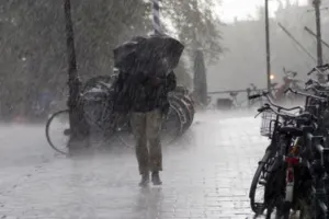
Turn around, don't drown when encountering flooded roads. Most flooddeaths occur in vehicles.Be aware of your surroundings and do not drive on flooded roads.
* WHAT...Flooding caused by excessive rainfall is expected.* WHERE...A portion of south central Wisconsin, including thefollowing counties, Green and Rock.* WHEN...Until 1100 PM CDT.* IMPACTS...Minor flooding in low-lying and poor drainage areas.Water over roadways.* ADDITIONAL DETAILS...- At 751 PM CDT, the public reported heavy rain in New Glarusdue to thunderstorms. Minor flooding is ongoing or expectedto begin shortly.- Some locations that will experience flooding include...Janesville, Monroe, Milton, Edgerton, Evansville, Brodhead,Belleville, New Glarus, Clinton, Orfordville, Brooklyn,Monticello, Albany, Footville, Fulton, Magnolia, Dayton,Tiffany, Browntown and Cooksville.- http://www.weather.gov/safety/flood