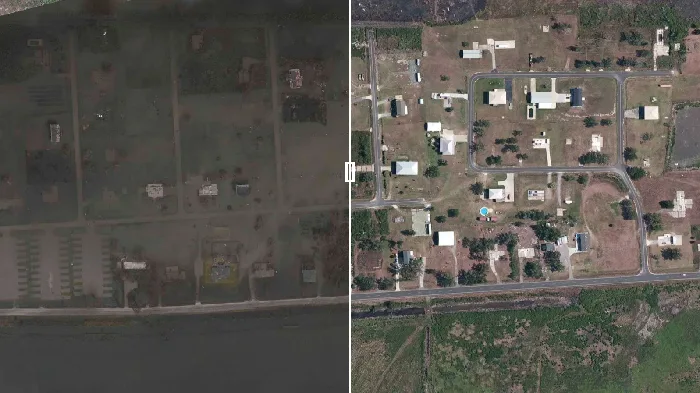
See it: NOAA releases before and after images of Hurricane Laura

The footage was captured between August 27 and 31, 2020.
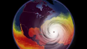
On August 27, Hurricane Laura made landfall along the Louisiana and Texas coastline as a Category 4 storm with wind speeds upwards of 215 kilometres per hour.
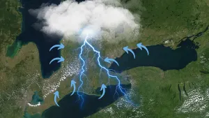
Flash floods and heavy rain accompanied the storm, causing widespread destruction. In Lake Charles, Louisiana, the storm created a swath of damage that spanned 8 million cubic yards, a number that may increase as more data becomes available, NOAA says.
Between August 27-31, the National Geodetic Survey (NGS) satellite collected images of the storm's aftermath.
NOAA worked in coordination with state and federal partners to collect images in specific areas targeted by the storm.
"Aerial imagery is a crucial tool to determine the extent of the damage inflicted by flooding, and to compare baseline coastal areas to assess the damage to major ports and waterways, coastlines, critical infrastructure, and coastal communities," NOAA says in a statement on its website.
"This imagery provides a cost-effective way to better understand the damage sustained to both property and the environment."
NASA satellites also captured the storm and the space agency says it's busy processing and analyzing the data it collected.
"NASA’s Disasters Program creates easily accessible information and distributes it to those working to manage disasters – hurricanes, tsunamis, floods, severe storms and weather, fires, earthquakes, volcanoes, and oil spills," NASA says on its website.
"That information helps disaster management personnel prepare for these events and plan recovery efforts. NASA also uses these events to study extreme storms and natural disasters and their impact on our planet – and prepare for events in the future."
Check out the video above to see the startling footage.
All 'after' images were captured between August 27 and 31, 2020. "Before" imagery is provided by Mapbox, Digital Globe, and OpenStreetMap; "After" imagery was captured by NOAA's National Geodetic Survey.