The science behind the 'classic fall storm'
Meteorologist
Wednesday, October 3, 2018, 4:04 PM - Powerful winds. Rapid swings in temperature. And a mixed bag of precipitation to boot.
These might not be the weather terms you'd immediately think of when describing Canada during the fall, but to meteorologists they describe a particularly impactful weather phenomenon that routinely occurs late in this oft-revered season: the "classic fall storm".
You may have heard this term used before here on The Weather Network, but have you ever wondered what it means? What’s so “classic” about them? And more importantly, why do they form in the fall?
For the inquisitive minds out there, it’s time to don your science cap again and read on to learn the science behind the 'classic fall storm.'
THE 'CLASSIC FALL STORM' DEFINED
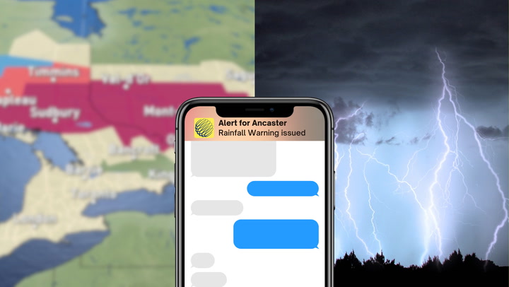
Whenever meteorologists refer to a "classic fall storm" (or CFS for short) they are describing a particularly impactful low pressure system that is characterized by very strong winds, sharply defined warm and cold fronts, and capable of producing heavy precipitation (of all forms).
![]() STORM TOOL KIT: Be prepared for severe weather with The Weather Network's online essentials: ALERTS | LIVE RADAR | UPLOAD PHOTOS/VIDEOS | LATEST NEWS | FOLLOW ON TWITTER | HIGHWAY FORECAST | AIRPORT FORECAST
STORM TOOL KIT: Be prepared for severe weather with The Weather Network's online essentials: ALERTS | LIVE RADAR | UPLOAD PHOTOS/VIDEOS | LATEST NEWS | FOLLOW ON TWITTER | HIGHWAY FORECAST | AIRPORT FORECAST
These storms most commonly form in the latter half of the fall season, and can impact Canadians coast-to-coast. Their regularity and frequency during this time of year is what makes them so “classic,” with certain atmospheric patterns most commonly found in fall at the core of their formation.
These patterns are described in detail below.
THE CRUCIAL ROLE OF RADIATIONAL COOLING AND THE JET STREAM
With the taste of turkey and stuffing now only cherished memories, it won’t be long before the clocks fall back and we regain a precious hour of sleep (except in Saskatchewan, of course). This extra hour, although largely revered, comes with a hefty price tag: the days are now noticeably shorter than you’d deem appropriate.

Shorter days mean longer nights, and with longer nights comes colder temperatures. This is due to a process known as radiational cooling – the process by which the Earth loses (or radiates) the heat that it gained while the sun was up after the sun has dipped below the horizon.

But in Canada's far north, for example, the sun barely rises above the horizon these days (if at all) leading to more energy radiating away from the Earth than coming in. This is what makes the air here near the surface so very cold, with little reprieve until the sun returns in spring.
In the more southern latitudes, meanwhile, the sun stays up for (comparatively) longer and as a result the air at the surface is not nearly as cold because less radiational cooling is taking place. This can create a strong temperature gradient between southern and northern locations.
This difference in temperature is called the horizontal temperature gradient, and when it is maximized (i.e. when there is a big temperature difference over a short distance), the jet stream many kilometres above the surface strengthens (read: speeds up).

In addition to strengthening, the jet stream also becomes quite amplified – developing pronounced ridges and troughs as in the figure above – and markedly separates warm and cold air masses (cold to the north of it; warm to the south). Because the jet stream acts like a giant conveyor belt of air moving at speeds of over 300 km/h, it does an excellent job of bringing cold, arctic air to the more southern latitudes -- as unwanted as that may be!
As the air descends from the north, it encounters the comparatively warmer air of the south, and creates a front (or boundary) between the two air masses. If the conditions are just right, it will be along this boundary where meteorologists will be looking for any potential CFS development.

CFS FORMATION, INTENSIFICATION, AND IMPACTS
Most commonly, our CFS will develop on the surface to the east of the upper-level trough of the jet stream (as shown below). Here, the surface pressure of the air is relatively low compared to the air in the trough, as it is warmer. This pressure difference draws air inward toward the centre of low pressure in a process called convergence, which rises vertically in the atmosphere, cooling and forming clouds in the process.
Eventually this rising air reaches a point where it can no longer rise (vertical motion becomes inhibited) so it is forced to move out horizontally aloft in a process called divergence. While divergence happens regardless of where the jet stream is located, divergence aloft can increase quite dramatically when the air that rose up from the surface interacts with the air "rounding the bend" of the upper level trough in our jet stream; remember, this air is travelling at 300 km/h!

If the air aloft is being displaced horizontally at a speed that is faster than it is rising from the surface, the air pressure at the surface will drop (or intensify). This is a direct result of more air being drawn in at the surface in order to re-balance the amount that is diverging aloft.
In striving for that balance, the wind speed at the surface will rapidly increase, drawing in as much warm air as possible into the centre of the low. This process creates a noticeable boundary between the warm and cold air, and results in clearly defined warm and cold fronts. No longer is our surface low just a low, a CFS in earnest.
The CFS will begin to move in the direction of the jet stream. For those living in its direct path, this can mean transitioning from warm, moist air, into very dry, cold air in a matter of hours. This clash between warm and cold air leads to precipitation (even frozen types) and can become quite deadly when combined with strong winds. It is not uncommon for trees to lose many of their leaves (or whatever remained) during these events, which can lead to clogged sewer drains and increase flash flood potential.
![]() NOW ON YOUTUBE: Subscribe to The Weather Network's YouTube channel for access to the best weather-related videos in Canada VIEW THE CHANNEL | VIEWER VIDEOS | POPULAR NOW | SUBSCRIBE
NOW ON YOUTUBE: Subscribe to The Weather Network's YouTube channel for access to the best weather-related videos in Canada VIEW THE CHANNEL | VIEWER VIDEOS | POPULAR NOW | SUBSCRIBE
Eventually, once the CFS and upper-level trough of the jet stream are no longer moving at the same speed, the divergence aloft slows down, and the CFS weakens. Wind speeds at the surface slow down, the warm and cold fronts become less defined, and precipitation becomes less heavy and more scattered.
And just like that, our CFS has come and gone, leaving many people to clean up in its wake.
Now hopefully the next time you hear us mention a "classic fall storm" is headed your way, you’ll have a better idea of what to expect!