Active Alerts Ames, TX
Motorists should not attempt to drive around barricades or drivecars through flooded areas.Turn around, don't drown when encountering flooded roads. Most flooddeaths occur in vehicles.Additional information is available at www.weather.gov/hgx.The next statement will be issued by Wednesday afternoon at 315 PMCDT.
...The Flood Warning continues for the following rivers in Texas...Trinity River at Liberty affecting Liberty County.Trinity River at Riverside affecting Walker, Trinity, Polk andSan Jacinto Counties.Trinity River near Moss Bluff affecting Liberty and ChambersCounties.For the Trinity River...including Crockett, Riverside, Romayor,Goodrich, Liberty, Moss Bluff...Moderate flooding is forecast.* WHAT...Minor flooding is occurring and minor flooding is forecast.* WHERE...Trinity River near Moss Bluff.* WHEN...Until further notice.* IMPACTS...At 15.2 feet, Moderate lowland flooding begins in thevicinity of the gage.* ADDITIONAL DETAILS...- At 8:30 PM CDT Tuesday the stage was 13.2 feet.- Bankfull stage is 9.2 feet.- Recent Activity...The maximum river stage in the 24 hoursending at 8:30 PM CDT Tuesday was 13.5 feet.- Forecast...The river is expected to rise to 13.9 feet Sundaymorning. Additional rises are possible thereafter.- Flood stage is 12.2 feet.- Flood History...This crest compares to a previous crest of14.0 feet on 02/13/2005.- http://www.weather.gov/safety/flood
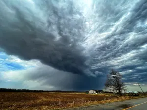
If outdoors, consider seeking shelter inside a building.
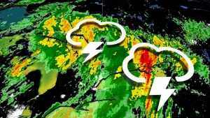
At 922 AM CDT, Doppler radar was tracking strong thunderstorms alonga line extending from near Industry to 6 miles southwest of Nome.Movement was south at 25 mph.HAZARD...Wind gusts up to 40 mph.SOURCE...Radar indicated.IMPACT...Gusty winds could knock down tree limbs and blow aroundunsecured objects.Locations impacted include...Pasadena, Pearland, League City, Sugar Land, Baytown, Missouri City,southern Conroe, Galveston Causeway, Galveston Island West End, TexasCity, Friendswood, La Porte, Deer Park, Rosenberg, Alvin, Dickinson,Stafford, South Houston, Bellaire, and Brenham.